Home / Map App How-Tos
Map App How-Tos
Step-by-step help for Google Maps, Apple Maps, OpenStreetMap, and other map apps: the exact taps and clicks to finish the job you opened the app for.
- Apple Maps for Business: Claim and Manage Your Listing in Apple Business
Your business already has a place card on Apple Maps, and Apple Business, the free owner portal that replaced Apple Business Connect in 2026, is where you take control of it. This guide walks the whole job: signing in at business.apple.com, claiming or adding your location, passing verification by phone call or document review, and setting every field on the card customers see, including the map pin you can drag separately from your street address, categories from Apple's own taxonomy, regular and special hours, photos, action links, and Showcases. It also states plainly what the portal cannot do for your ranking.
- Apple Maps Not Working? A Symptom-First Fix Ladder for iPhone
Most fix lists for Apple Maps throw every toggle at every problem in random order. This guide starts from your exact symptom, a blank grid, a wandering blue dot, directions that refuse to start, or an app that will not open, matches it to its likely cause, and then walks one ordered fix ladder from the 30 second checks to the resets, telling you what each reset erases before you tap it.
- Apple Maps on Android: What the Web Version Can and Cannot Do
There is no Apple Maps app in the Play Store, and there never has been. What exists is a surprisingly capable web version at maps.apple.com that runs in your Android browser. This guide shows how to open it, pin it to your home screen so it behaves like an app, and, just as honestly, lists what it cannot do on Android: no spoken turn-by-turn navigation, no offline maps, and no syncing with the places saved on your iPhone.
- Apple Maps Online: How to Use Apple Maps in a Browser on Any Computer or Phone
Apple Maps has a web version at maps.apple.com that runs in any modern browser, including on Windows PCs and Android phones where no Apple Maps app exists. This guide covers what the online version does well (search, place cards, directions you can print or send to your phone), what it cannot do at all (voice navigation and offline maps), the sign in question, and the DuckDuckGo back door that has quietly used Apple map data for years.
- Apple Maps Street View: How to Use Look Around and Check If Your City Has It
Apple's answer to Street View is called Look Around, and it hides behind a binoculars icon that many iPhone owners have never tapped. This guide shows every way into it on iPhone, iPad, Mac, and the web, how to move through a street once you are inside, how to check in 30 seconds whether your city is covered at all, and how Look Around honestly differs from Google Street View in coverage, image style, and privacy.
- Apple Maps vs Google Maps
A verdict driven comparison of Apple Maps and Google Maps across navigation, traffic, offline maps, privacy, coverage, transit, and car integration, ending with a clear pick for your situation.
- Apple Maps vs Google Maps Accuracy: Three Kinds of Accurate, and a Test You Can Run Yourself
Which is more accurate, Apple Maps or Google Maps?" is really three questions wearing one coat: whose blue dot sits closest to where you stand, whose map data knows your street exists, and whose arrival time you can trust. This article scores each axis separately, explains why the answers differ by city and countryside, and ends with a two-phone self-test, using this site's Coordinate Explorer, that settles the question for your own streets instead of a reviewer's.
- Apple Maps vs Google Maps for Driving: Lane Guidance, Voice Prompts, and Rerouting Compared
For driving, Apple Maps and Google Maps differ where it matters most: at the next turn. Google Maps brings deeper live traffic, incident reports from its huge driver base, and Android Auto. Apple Maps answers with cleaner lane guidance, natural spoken directions that name landmarks and traffic lights, and deep CarPlay polish. This comparison judges both apps only as driving tools: guidance at complex junctions, rerouting behavior, multi-stop limits (9 stops on Google, 15 on Apple), offline behavior, and what each one does on the dashboard screen, so you can pick by how you actually drive.
- Apple Maps vs Google Maps on CarPlay: Which One Deserves Your Dashboard
On CarPlay the contest between Apple Maps and Google Maps is not the phone contest moved to a bigger screen. Apple Maps is the built in default with the deepest Siri and Apple Watch integration, while Google Maps brings its place data, satellite view, and incident reporting to the dashboard. This guide judges both apps on the axes that only exist in a car, voice, glanceability, offline behavior, and EV routing, and ends with a pick by driver type.
- Apple Maps vs Google Maps Traffic Accuracy: Whose Congestion Data and ETAs to Trust
Traffic accuracy is three different contests wearing one name: how current the congestion colors are, how honest the estimated arrival time is, and how early a reroute saves you. Google Maps reads the larger live signal, fed by Android phones, Maps users, and the Waze report stream Google has owned since June 11, 2013, while Apple Maps has grown strong on learned regular routes. This guide separates the three contests, gives you a self test that settles the question on your own commute, and states plainly where each app's traffic data goes blind.
- Apple Maps vs Google Maps vs Waze
A three-way decision between Apple Maps, Google Maps, and Waze: which one finds places best, which one drives a commute best, which one survives a road trip, and the one situation that should flip your pick.
- Best Map App for Android Auto: The Car Screen Changes the Contest
The best map app on your phone is not automatically the best map app on your dashboard. Android Auto shrinks every app down to big touch targets, voice commands, and whatever survives a two second glance, and it locks the keyboard while you move. This guide judges the Android Auto navigation field on car screen axes only: glanceability, voice control, offline behavior, incident alerts, and what each app hides behind a subscription, with a pick for commuters, road trippers, and drivers who lose signal.
- Best Map App for Android: Picks by Commuter, Traveler, Hiker, and Privacy First User
Android roundups usually rank map apps by novelty or by how they look on a car screen, and bury the facts that decide daily life: how good the place listings are, what the free tier actually caps, how deep the offline mode goes, and what the app costs in battery, storage, and data about you. This guide compares the real contenders on those axes and ends with a pick for each kind of Android user, plus the checklist the tool above turns into a decision.
- Best Map App for China: Amap, Apple Maps, Baidu, and the Google Maps Problem Explained
China is the one major country where your usual map app strategy falls apart, because Google Maps is blocked, GPS coordinates are deliberately shifted, and the best data lives in local apps. This guide explains the GCJ-02 coordinate shift in plain terms, compares Amap, Apple Maps, Baidu Maps, and Google Maps over a VPN, and gives you the setup to complete before you land.
- Best Map App for Driving: Alerts, Offline Truth, and Multi Stop Limits Compared
Driving is the one map job where the apps genuinely diverge, and the brochures hide it. Waze hears about the crash ahead first but cannot plan a route offline at all, Google Maps caps a multi stop route at nine stops, and Apple Maps quietly allows fifteen. This guide compares the three driving apps on the axes that decide real trips, incident alerts, offline behavior, stop limits, lane guidance, and dashboard fit, then names the right primary app for commuters, road trippers, and multi stop drivers.
- Best Map App for iPhone: The Honest Pick for Driving, Walking, and Travel
The best map app for iPhone depends on which iPhone jobs you actually do, because Apple Maps, Google Maps, and Waze each win a different one. Apple Maps is the built-in default that Siri, CarPlay, and your lock screen already assume, Google Maps still owns the deepest business listings and reviews on Earth, and Waze remains the commuter alert machine. This guide scores all three on the axes that matter specifically to iPhone owners, default behavior, privacy labels, offline truth, and free tier reality, then gives one clear pick per kind of user.
- Best Map App for Japan: Google Maps for Streets, NAVITIME for Trains, and the Two-App Setup
Japan rewards travelers who split the job between two apps. Google Maps is the best all-round street and walking map, but its offline maps drop transit entirely, and Japan's rail network deserves a specialist. This guide compares Google Maps, Japan Travel by NAVITIME, Yahoo! Maps, and Jorudan, and shows the two-app stack that handles both the street and the shinkansen.
- Best Map App for Korea: Why Naver Map Beats Google Maps There
South Korea is the famous exception to Google Maps' world coverage. Because Korean law restricts the export of high-precision map data, Google Maps has never offered full turn-by-turn driving or walking navigation there, and the apps Koreans actually use are Naver Map and KakaoMap. This guide explains the restriction, compares the local champions against what Google still does well, and gives you the exact setup to land with.
- Best Map App for RV Travel: Route Around the Bridge, Not Into It
A car navigation app will happily route a 13 foot motorhome under an 11 foot bridge, because it does not know your rig exists. RV travel apps earn their keep with one feature cars never need: a vehicle profile with your height, weight, length, and propane status that filters every route before you see it. This guide compares the dedicated RV navigation options, explains the low clearance and weight limit data they draw on, and gives a pick by rig type, from camper vans to fifth wheels.
- Best Map App: The Right Map for the Way You Travel
The best map app depends on the job: driving alerts, city transit, hiking trails, offline travel, or privacy. Quick picks by use case, an honest comparison table, and a decision checklist that turns your own travel pattern into the right install.
- Best Walking Map App: The Right Pick for Your Kind of Walk
The best walking map app depends on the walk: a new city on foot, a step-free route, a countryside path, or a foreign trip with no data. Winners named per walk type, an honest axis table, and the one warning that decides more walking trips than any feature list: what still works when the signal dies.
- Download Maps Offline in Waze: The Honest Answer and the Workaround That Works
Waze does not offer a true offline map download, and its own help pages say that without an internet connection you cannot locate or navigate a route. What Waze does keep is a cache of a route you planned while online, which survives a short signal gap but cannot create new routes, search, or reroute. This guide explains exactly what works and what does not, shows the route caching workaround step by step, and sets up the reliable alternative: downloading the same trip as an offline area in Google Maps or Apple Maps before you leave.
- Google Map to Image: Save, Print, Embed, or Generate a Map Picture
Getting a Google map out as an image is four different jobs wearing one search query. A screenshot is fastest and fine for personal use. Print to PDF gives a clean, scaled page for documents. An embed puts a live map on a website. And the Maps Static API generates a proper image file by URL, with markers and paths drawn in, for anyone willing to use an API key. This guide compares all four routes honestly, including the attribution and terms limits on reusing Google imagery, and adds the OpenStreetMap export route for images you can freely republish.
- Google Maps Add a Stop: Multi-Stop Routes and Stop Order, Explained
Two different features hide behind the words add a stop in Google Maps: adding stops to a route before you drive, and adding one while you are already navigating. Both are taught here with current menu names, plus the limit nobody mentions (nine stops), the geographic ordering method, and what to do when the option is missing.
- Google Maps Aerial View: The Four Above-the-Ground Views, Untangled
People ask Google Maps for an aerial view and get four different things depending on the device: flat satellite imagery, the tilted 3D Globe view, 45 degree oblique imagery, and Immersive View. Google never named any of them aerial view, which is exactly why the question is confusing. This guide names each view, shows where it lives on desktop and mobile, and tells you which one answers which question.
- Google Maps Alternatives: The Honest Switch Guide for Drivers, Hikers, and the Privacy Minded
Leaving Google Maps is easy to start and surprisingly specific to finish: what you lose is live traffic and place data, and what you gain depends entirely on which alternative you pick. This guide profiles the real candidates (Organic Maps and its fork CoMaps, OsmAnd, Apple Maps, HERE WeGo, Waze, and Magic Earth), states plainly what each one cannot do, and gives the switching steps that preserve your saved places as far as any tool allows.
- Google Maps Bus Route: Get Bus Directions With Stops, Times, and Transfers
Google Maps will happily route you by car unless you tell it otherwise. This guide shows how to get a true bus route: switching directions to transit, forcing a bus preference in route options, reading the itinerary leg by leg with stop names and walking segments, and using departure and arrival time planning. It also covers why bus directions sometimes vanish and what to check when they do.
- Google Maps EV Trip Planner: Set Your Plugs, Add Charging Stops, and Know Its Limits
Google Maps can plan an electric road trip, but only after you teach it your car. Set your connector types once and the map filters stations to plugs that fit, suggests charging stops on cars with Google built in, and shows charger speeds along any route. This guide covers the full setup on phone and in car, how to read a station listing, and where the planner stops and a specialist like ABRP takes over.
- Google Maps Fires: How to See Wildfires, Smoke, and Air Quality on the Map
Google Maps carries a wildfire layer that most users never turn on: under Layers and Map details, the Wildfires switch draws flame icons and red perimeter polygons for active fires, and tapping a fire opens an incident card with its name, containment, and acreage. Beside it sits an Air Quality layer that colors the map by the EPA Air Quality Index, the smoke information that often matters more than the flames. This guide shows how to turn both layers on, how to read what they show, where the data comes from, and where the map stops and local authorities take over.
- Google Maps Flight Simulator: It Lives in Google Earth Pro, and Here Is How to Fly It
There is no flight simulator inside Google Maps, which is why looking for one there always fails. The simulator people mean lives in Google Earth Pro, the free desktop program: open Tools, Enter Flight Simulator, or press Ctrl+Alt+A, and you can fly an F-16 or a propeller SR22 over the real Earth, starting from your current view or from a real airport runway. This guide gives the full control table, a first flight that ends in a landing instead of a crash, and an honest note about a conflicting web version described in newer documentation.
- Google Maps for Boats: What It Can and Cannot Do on the Water
Google Maps has no boat mode, and the reasons are matters of safety, not missing features: it carries no depth soundings, no channel markers or buoys, no tides, and its shoreline detail is cartography rather than a nautical chart. This guide separates what Google Maps is genuinely useful for ashore, marinas, ramps, planning, and measuring, from the navigation jobs that belong to official charts and marine apps built on them.
- Google Maps Gas Prices: Find Prices Along Your Route and Read Them Right
Google Maps shows gas prices on station listings in many countries, lets you search prices along a route, and hides two traps: prices can be stale, and the grade you need may not be the grade displayed. This guide shows how to find prices, filter by your fuel grade, use the fuel-efficient routing option, and judge when a cheaper station is not worth the detour.
- Google Maps Historical Imagery: Street View Dates in Maps, Satellite History in Earth
Google Maps does hold historical imagery, but only one kind: past Street View photography, reachable through the See more dates control, with an archive that reaches back to 2007 in the first photographed cities. The historical satellite imagery most people go looking for is not in Maps at all; it lives in Google Earth. This guide separates the two archives, shows the exact taps for each, and explains what neither of them can do.
- Google Maps Location Sharing vs Life360: Free Built-In or Full Family Safety App
Google Maps location sharing is free, already on your phone, and ends when you say it ends, while Life360 is a dedicated family safety service whose best features, crash detection, SOS, and long location history, sit behind a subscription. Both read the same phone GPS, so accuracy is a tie. This comparison lays out the free limits, the paid tiers, the alert rules, and the privacy trade, then tells you which households should pay and which should not.
- Google Maps Property Lines: What Those Lines Are and Where Real Boundaries Live
Google Maps has no property line layer, and the thin parcel-like lines you can sometimes see at high zoom are not survey data and carry no legal weight. The real boundaries live in county GIS parcel viewers, recorded plat maps, and aggregators that license county data, and the only boundary that counts in a dispute is one a licensed surveyor marks on the ground. This guide answers the myth first, then ranks the four real routes by what you are actually trying to decide.
- Google Maps Radius Tool: How to Draw a Circle When Maps Refuses To
Neither Google Maps nor Google My Maps can draw a radius circle natively, which surprises everyone who goes looking for the button. The working routes are third-party circle tools that sit on top of Google Maps, a KML circle imported into My Maps, the circle mode of the Google Earth Pro ruler, and the Circle class in the Maps JavaScript API. This guide walks each route, shows how to check a circle before trusting it, and asks the question that changes the answer: whether you need geometry at all, or a drive-time polygon instead.
- Google Maps Saved Places: Favorites, Want to Go, Starred, and Your Own Lists
Saving a place in Google Maps is one tap, but where the place lands decides whether you ever find it again. Maps gives you four built-in lists with different jobs, plus custom lists you can share, and Google Help documents real limits, including 3,000 entries per list and a desktop quirk that keeps starred places unshareable. This guide sorts the system: which list a place belongs in, what the limits are, and how sharing actually works.
- Google Maps Speed Limit: The Two Switches, the Rollout, and Why the Posted Sign Wins
Google Maps can show the speed limit of the road you are on and your current speed beside it, but only while you are navigating, and only where Google has the data. Two separate switches in Navigation settings control the two readouts, they arrived on different platforms in different years, and Google itself warns that the display is informational only. This guide explains both switches, the availability puzzle, and the posted sign rule.
- Google Maps Timeline: How the On-Device History Works Now
Google Maps Timeline changed fundamentally in 2024. Your visits and routes now live on your phone instead of on Google's servers, the web version is gone, Timeline is off until you turn it on, and backups are encrypted per device. This guide explains the current storage model, the version floors your phone must meet, the auto delete choices at 3, 18, and 36 months, and how to export what you have before it ages away.
- Google Maps Traffic: Read the Colors, the Closures, and Typical Traffic Right
The Google Maps traffic layer is a system, not a decoration: colors that compare live speed with the road's normal speed, incident icons, a dotted red that means closed rather than slow, and a Typical traffic view that shows the historical pattern for planning. This guide turns the layer on, teaches the reading, and explains where the data comes from and where it simply does not exist.
- Google Maps Update: What Changed, and How to Get the New Version
A Google Maps update can mean two different things: the new features Google just announced, or the app update sitting in your store waiting to install. This guide covers both, with the exact update steps for Android and iPhone, a version check routine, and a plain explanation of why a feature your friend has may not appear on your phone for weeks.
- Google Maps vs Waze: Same Owner, Opposite Instincts
Google has owned Waze since 2013, yet the two apps remain opposites. Waze is a single purpose driving instrument fed by its crowd: the earliest incident alerts, and no ability to plan a route without a connection. Google Maps is the everything atlas: places, reviews, transit, walking, and offline driving maps, with incident reports borrowed from its sibling. This pairwise guide scores the driving contest axis by axis and gives a verdict for commuters, road trippers, and drivers in dead zone country.
- Google Maps Zoom Levels and Scale: What Each Zoom Number Shows on the Ground
Google Maps zoom is a number, usually from 0 to about 21, and each step doubles how much ground detail fits on screen. This guide converts zoom into ground truth: the meters per pixel formula with worked values at the equator and at 40 degrees latitude, what you can actually see at the landmark zooms (3, 10, 15, 18, 20), why the scale bar beats the ratio on a screen, and how digital zoom relates to the paper map scales hikers still use.
- Google Maps: How to Scan a QR Code (and How to Make One for Your Location)
Google Maps has no QR scanner built in, and it does not need one. Your phone's Camera app or Google Lens reads the code, and the link it contains opens the place directly in Google Maps. This guide walks through scanning on Android and iPhone, explains what to do when a code opens a web page instead of the app, and then reverses the process: how to create your own QR code for a location using the share link, and how to test it before you print it on a sign, invitation, or listing.
- How Often Is Google Maps Updated? The Honest Answer, Layer by Layer
There is no single update cycle for Google Maps, because the map is not one thing. Traffic refreshes continuously, road data changes on a rolling basis as reports and imagery are processed, satellite photographs are recaptured on a cycle of years that favors cities, and Street View cars revisit on their own multi-year rounds. Google publishes no per-layer schedule, so this guide gives the honest ranges, explains why your street and a capital city live in different decades of freshness, and shows what you can actually do when the map is wrong.
- How to Add a Business to Google Maps: Claim, Create, and Verify the Profile That Puts You on the Map
Adding a business to Google Maps is not filling in a pin form. It is creating or claiming a Google Business Profile, choosing the name and category under rules Google enforces, and passing a verification Google designs, with timelines Google states: review that can take up to five business days and a postcard that can take up to fourteen. This guide walks the owner-side process in order, from the duplicate check that prevents the most common failure to the fields that decide whether customers actually come.
- How to Add Multiple Pins in Google Maps: Lists for Pins, My Maps for Projects
There are two honest answers to putting many pins on one Google map, and picking the wrong one wastes an afternoon. Inside the Maps app, the answer is a saved list: save each place to one list and every pin appears together on a single map. For a real custom map with your own colors, icons, and layers, the answer is Google My Maps. This guide teaches the list method step by step, shows how to make a list genuinely useful, and draws the exact line where you should hand the job to My Maps instead.
- How to Add Your Home Address on Google Maps: The Labeled Pin, Done Right
One labeled pin quietly powers half of Google Maps: directions home in one tap, commute estimates, and the words take me home spoken to the Assistant. This guide shows how to add the Home label on a phone and on a computer, when to drop the pin instead of typing the address, how to change or remove the label when you move, and the privacy trade-off that should decide exactly where you put the pin.
- How to Add Your Home Address to Google Maps (and Work, Change, or Remove It)
Setting Home and Work in Google Maps takes a minute and pays you back every day: one-tap directions, commute times on your home screen, and leave-now reminders that know where you live. This guide covers every way to add the labels (app settings, the Labeled list, your Google Account, or dropping a pin on the map), plus how to change them when you move and remove them when you should.
- How to Avoid Tolls in Google Maps: Route Options on Phone and Desktop
Google Maps hides its toll avoidance in Route options, one layer deeper than most drivers dig. On the phone it is Directions, the three dot menu, Route options, Avoid tolls; on desktop it is the Options panel beside your route. The setting is all or nothing, it travels with the route rather than your account, and it sits beside two siblings, Avoid highways and Avoid ferries, that solve different problems. This guide walks both platforms, explains when the toll free route is a bad trade, and shows how to check the real cost of avoiding a toll before you commit.
- How to Blur Your House on Google Maps: What It Hides, What It Never Will, and How to File the Request
Blurring your house on Google Maps is permanent, takes minutes to request, and covers far less than most people assume: Street View only, never the satellite view, never the address pin, never photos other people uploaded. This guide puts the honest can and cannot table first, then the Google request step by step including the proof of address rules, then the equivalent requests on Apple Look Around and Bing Streetside, so you file once, correctly, with your eyes open.
- How to Change the Car Icon in Google Maps: Swap the Blue Arrow for a Vehicle
The Google Maps car icon is changed from inside an active navigation session, not from the app's Settings menus: start a route, tap the blue arrow that represents you, and pick a vehicle style or a new arrow color from the tray that opens. The choice is cosmetic, it lives on the device rather than in your Google account, and it changes nothing about how your position is calculated. This guide gives the exact steps on Android and iPhone, explains why the setting hides where nobody looks for it, and covers what to do when the icon resets or refuses to change.
- How to Change the Voice in Google Maps
Change the Google Maps navigation voice on Android with the built-in Voice selection menu, and on iPhone by changing the system language voice, with the volume, Bluetooth, and troubleshooting steps that make the change actually stick.
- How to Change Your Home Address in Google Maps: The Account Route That Actually Sticks
Most guides for changing your Home address in Google Maps send you down a retired path through Saved and Labeled, which is why the change so often fails to stick. Home is an address stored on your Google Account, under Personal info and Addresses, and it follows the account to every signed in device. This guide gives the current account route first, then the in app route, explains the difference between your Home label, a contact address, and a public map pin, and covers the Work address and the fixes for a change that will not save.
- How to Drop a Pin on Google Maps
Drop a pin on Google Maps in seconds on Android, iPhone, and desktop, then save it, share it, read its coordinates and plus code, and remove it when you are done.
- How to Find Alternate Routes in Google Maps: The Gray Lines, Explained
Google Maps almost always computes more routes than the blue one it recommends. The alternates sit on the map as gray lines with their own time labels, before you start driving and while you are already moving, and most drivers never learn where they hide or when a slower-looking gray line is actually the smarter drive. This guide shows every surface where alternates appear, how to drag a route onto your road on desktop, and how the avoid toggles quietly reshape every route you are offered.
- How to Find Your Parked Car With Google Maps: Save the Spot, Add the Note That Actually Matters
Google Maps can remember where you parked, automatically when your phone disconnects from the car or manually with two taps on the blue dot. This guide covers both methods on Android and iPhone, the different rules each platform follows (the iPhone pin expires in 48 hours, the Android pin stays until you remove it), how to walk back to the car, and why the level and row note matters more than the pin in a parking garage.
- How to Hide Labels in Google Maps: The Clean Map, Desktop and Phone
Hide labels means three different jobs in Google Maps, and each has a different answer. Public map labels come off only on desktop, in Satellite view, through Layers and More, and the setting resets on reload. Your own private labels are removed one by one from the Labeled list. Saved list markers hide per list, with Hide on your map. This guide separates the three, gives each its exact steps, and is honest about the phone, where no public label switch exists.
- How to Import a GPX File Into Google Maps: The My Maps Route, Step by Step
Google Maps itself cannot open a GPX file, but Google My Maps, the same account's custom map maker, imports GPX directly, along with KML, KMZ, CSV, and spreadsheets, and the result opens inside the Google Maps app on your phone. This guide walks the import step by step, explains the documented limits that make big tracks fail, and fixes the common errors.
- How to Import a KML File Into Google Maps: My Maps Layers, Placemarks, and the Limits That Shape the Job
A KML file is Google Earth's native language: named placemarks with styles and descriptions, saved from Earth, a GIS, or a collaborator's project. Google Maps itself will not open one, but Google My Maps will, into layers you can then open on your phone. This guide runs the import step by step, states the documented limits that shape it, 5 MB of uncompressed KML or KMZ and 2,000 rows per layer, and is honest about what does not survive the trip, from Earth tours to 3D models.
- How to Label Places in Google Maps: Private Names That Stay Yours
A private label in Google Maps renames a place for your eyes only: your name for it appears on your map, in your search suggestions, and in Google Photos, while everyone else keeps seeing the standard name. This guide covers adding, renaming, and removing labels on phone and desktop, the Web and App Activity setting labels silently depend on, and the boundary between labels, saved lists, and the two standing labels, Home and Work.
- How to Leave a Review on Google Maps: Write It, Edit It, and Find Every Review You Have Ever Left
A Google review is public, attached to your profile name, and permanent unless you edit or delete it, and Google's own help is blunt that there is no anonymous option. This guide writes a review the way Google Maps actually asks for one, stars, story, the extra detail questions, and your own photos, then covers the half nobody explains: finding your reviews again through Contribute, and editing or deleting them when the place, or your opinion, has changed.
- How to Look at Older Images on Google Maps: Street View Dates, Step by Step
Google Maps quietly keeps the old photographs. Street View has been re-driving the same streets since 2007, and most of those earlier visits are still there, hidden behind a date label most people never tap. This guide shows how to open the archive on a computer and on a phone, how to read the capture dates honestly, why the satellite layer refuses to time travel inside Maps itself, and where the older aerial imagery actually lives.
- How to Measure Area in Google Maps: Close the Shape, Read the Land
Google Maps can measure the area of a field, a roof, or a plot of land, but only in one place: on a computer, where closing a measured shape turns the distance tool into an area tool. The phone app measures distance and stops there. This guide walks the desktop routine click by click, gives a worked example with real conversions, explains the Google Earth workaround for phones, and sets honest limits on how far a clicked outline can be trusted.
- How to Measure Distance on a Map App: Straight Line, Road, and Walking Numbers Explained
Ask a map app "how far is it" and you can get three different numbers for the same two places: the straight line measure, the driving route distance, and the walking route distance. This guide teaches the measuring tool step by step on Google Maps, states plainly that Apple Maps has no equivalent tool and gives the workaround, and shows you how to check any app's number against a verified straight line computed from the coordinates themselves.
- How to Print Directions From Google Maps: The Desktop Print Button, Text-Only Mode, and Saving as PDF
Printing Google Maps directions is a desktop-only feature with two modes that most people never see, because the Print button only appears after you build a route. This guide gives the exact steps, compares Print including maps against Print text only, shows how to save the same output as a PDF, and explains the case where print beats the phone entirely: multi-stop routes, which Google Maps refuses to send to your phone.
- How to Read Google Maps in Japan: Route Cards, Train Types, Mapcodes, and Exits
Google Maps in Japan is not hard to use, it is hard to read. The route card packs an operator, a line, a destination-named direction, a platform, and a train type into a few lines, and each field decides whether you board the right train. This guide walks through every field of a Japanese transit result, plus Mapcodes, phone number search, and the exit system that finishes the journey.
- How to Report a Road Closure on Google Maps: In Navigation, in Crisis, and for Good
Reporting a road closure on Google Maps is three different jobs wearing one name: an incident report filed from inside navigation for the closure in front of you right now, a crisis report for closures caused by floods, fires, and disasters, and a road edit for closures that will last, such as construction. Each route has its own steps, its own review path, and its own limits. This guide separates them, gives the steps for each, and explains what actually happens after you report, including why no fixed resolution time exists.
- How to Save a Route in Google Maps: Pin It, Shortcut It, Send It
Saving a route in Google Maps means four different things depending on where you tap, and only one of them keeps the route itself. You can pin a recommended driving route so it waits in the Go tab, put an Android shortcut to a route on your home screen, or send and share directions from a computer, but a custom route you dragged into shape cannot be pinned at all. This guide separates the four meanings, walks each one, and states plainly what saving does not preserve.
- How to Search Along a Route in Google Maps: Stops Judged by Minutes Added
Search along route is the Google Maps feature built for the moving car: with navigation running, one tap on the search bar opens quick categories, gas, restaurants, groceries, coffee, and every result is biased to the corridor ahead and annotated with the time it adds. This guide teaches the feature on phone and desktop, the detour-time discipline that makes it useful, and the boundary with building a stop list in advance.
- How to Search Nearby in Google Maps: Find Places Around Any Point
Nearby search in Google Maps answers two different questions that share one box: what is around me, and what is around a place I am not in. This guide teaches both, the Nearby button anchored to a searched place, the category near a place syntax, the chips, Search this area, and how Google ranks the results by relevance, distance, and prominence, so you can steer the ranking instead of just reading it.
- How to See How Busy a Place Is on Google Maps: Popular Times, Live Bars, and Waits
Google Maps keeps a crowd diary for millions of places: a chart of how busy each one usually is, hour by hour and day by day, plus a live bar showing how today compares. This guide shows where the chart hides on the place page, how to read bars that are scaled to each place's own peak, what the wait time and visit length lines really mean, and why some places show no chart at all.
- How to Use Apple Maps in CarPlay: The Complete First Drive Routine
Apple Maps in CarPlay rewards a ten minute setup done once in the driveway and punishes improvising at highway speed, because the keyboard locks while you move and half the settings live on the phone, not the car screen. This guide gives the complete first drive routine, connecting wired or wireless, the Dashboard view, the Siri commands that replace typing, adding a stop, sharing your ETA, and reporting an incident, so the system feels designed rather than discovered.
- How to Use Apple Maps on a Tesla: Every Working Option, Honestly Explained
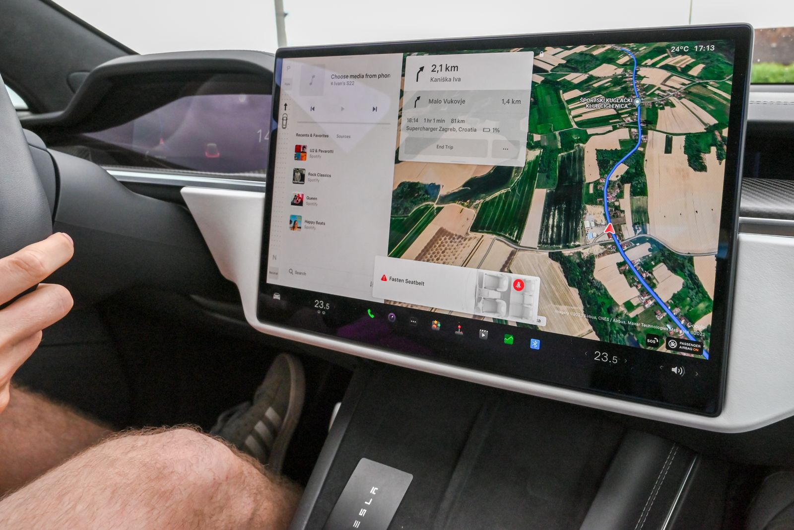
Tesla does not offer Apple CarPlay on any model, so Apple Maps cannot run natively on the Tesla screen, and no setting changes that. What you can do is combine four working options: send any Apple Maps destination to the car through the Tesla app in two taps, run Apple Maps on a mounted iPhone with its voice prompts playing through the car speakers, use an unofficial browser adapter that renders CarPlay inside the Tesla web browser, and let the built-in Tesla navigation handle the jobs only it can do, like Supercharger routing and battery preconditioning. This guide explains each option step by step, with the limits stated plainly.
- How to Use Apple Maps: The Complete First Session, From First Open to Offline Backup
Most Apple Maps guides are feature tours: they list what the app can do and leave you to assemble a working routine yourself. This guide is one complete first session in the right order. Set the two settings that decide whether the app works at all, decode the place card field by field, run a first trip with a stop added, save home and work, pin your favorites, and download your home area so the app keeps working when the signal dies.
- How to Use Google Maps Location Sharing: The Complete Feature Guide
Google Maps location sharing is deeper than the share button suggests. Shares run on a timer you set in 15 minute steps or stay on until you stop them, people without a Google account follow a link that lives for up to 24 hours, trip progress sharing narrates a single drive to people who are not regular contacts, and arrival and departure notifications watch places for you. This guide covers the full feature surface, the controls that end sharing, and the settings that keep it honest.
- How to Use Google Maps With Android Auto: Connect, Navigate, and Drive Hands Free
Android Auto puts Google Maps on the car screen so the phone can stay in your pocket. This guide covers the two ways to connect (a USB cable, or wireless after a one time pairing), setting Maps as the navigation app, starting a route by voice before you move, the dashboard layout, offline behavior in dead zones, and the fixes for the connection failures that strand drivers in parking lots.
- How to Use Google Maps: Your First Trip, Step by Step
A complete first trip in Google Maps, taught as one routine you perform alongside the article: find a place, read its card, get directions, choose a route, and follow the blue line to the door. Plus a decoder for the home screen and the place card, so every button you will ever tap is explained before you need it.
- How to Use Live View on Google Maps: AR Walking Directions on the Real Street
Live View is the one Google Maps feature that answers the question the blue dot never could: not where you are, but which way to face. It points your camera at the street and paints the arrows onto the buildings themselves. This guide covers what Live View is, the four requirements that decide whether your phone offers it, the exact start sequence, the calibration habit that makes it accurate, and the diagnosis ladder for when the button simply is not there.
- How to Use Street View in Google Maps
Open Street View on a phone or a computer three different ways, move around like you are standing there, check the capture date before you trust the picture, and run the pre-trip routine that finds the entrance, the parking, and the last turn before you travel.
- How to View Traffic in Google Maps: The Live Colors, Typical Traffic, and Reading a Route Before You Drive
Traffic in Google Maps is a layer, not a default view, and most people read it at the wrong zoom. This guide turns the layer on for phone and desktop, decodes the green, orange, red, and dark red color scale honestly, separates Live traffic from the Typical traffic planning view, and teaches the reading discipline that matters: judging a corridor by its route preview colors instead of one angry street, and treating an uncolored road as no data rather than a clear road.