Choosing the app is only half of navigating Japan. Our best map app for Japan guide settles that question: Google Maps for streets, a rail specialist for heavy train days. This article covers the other half, the skill the app cannot give you. A Google Maps result in Japan is a dense little document, and reading it correctly is the difference between gliding through Shinjuku and boarding a rapid train that skips your station entirely. Every field on the route card means something specific, and Japanese transit rewards people who read all of them.
How to Read Google Maps in Japan: Route Cards, Train Types, Mapcodes, and Exits
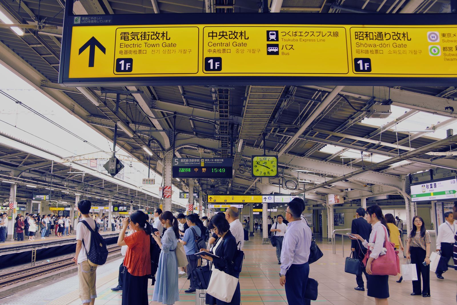
Photo: Bruna Santos / Pexels
Interactive tool
Reading the Route Card: Field by Field
Check off each step as you finish it. Your progress stays on this page.
0 of 7 complete
0% done
The Route Card, Field by Field
Tap Directions, choose transit, and Google Maps returns a route card. Read it top to bottom, because the fields stack:
- Operator and line. The first line names the railway company and the line, with the line's color chip. Tokyo has a dozen operators, and the color is how platforms and signs refer to the line, so match the color on the station signs, not just the name in your phone.
- Direction, named by destination. Japanese trains are described by where they are going, not by compass points. The card shows the destination station the train terminates at, and station departure boards show the same name. Your train is the one whose destination matches the card, even if your stop is only three stations along the way.
- Platform number. For major stations the card gives the platform. In a station with thirty platforms, this single number is the most valuable field on the screen.
- Train type. Local, rapid, express, and limited express services share the same tracks but stop at different stations. This field is covered in its own section below because it causes more visitor errors than everything else combined.
- Fare and time. The total fare in yen, the in-vehicle time, and the walking legs at each end. Walking time inside mega-stations is real time; a seven minute transfer inside Shinjuku is not padding.
Train Types: The Field That Decides Your Stop
The same line can run four kinds of train, and they do not stop at the same places:
| Type | Stops | Extra fare | Notes |
|---|---|---|---|
| Local (kakueki) | Every station | None | Slowest, always safe |
| Rapid (kaisoku) | Major stations only | None | Skips smaller stops |
| Express (kyuko) | Fewer still | None on most lines | Check the stop list |
| Limited express (tokkyu) | Fewest | Seat surcharge applies | Often reserved seating |
Google Maps chooses the fastest option, which is usually a rapid or express. Before you board, tap into the leg and read the stop list. If your station is not on it, the app has still done its job; it assumed you wanted speed. Switch to the local service one departure later, or ride the rapid to the nearest stop it does serve and change. Limited express trains add a surcharge on top of the base fare, and some are all-reserved, so a card that says limited express means check the fare breakdown before you tap in.
Reading the Walk: Exits Are Part of the Route
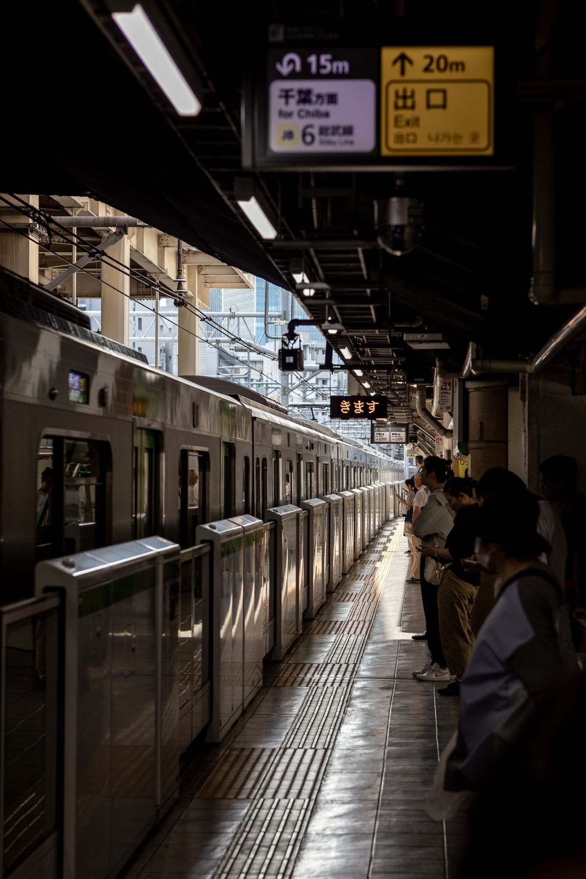
In Japan the journey does not end at the platform. Large stations have named and numbered exits, and the wrong one can put you on the far side of a rail yard from your hotel. Google Maps handles this better than visitors expect: zoom into the station and the map shows the internal layout, concourse levels, and exit positions, and walking directions from the platform area will name the exit to aim for. Follow the exit name exactly. Station signage is organized around exits, so once you know you want the South Exit or exit A4, the signs take over and the phone can go away. Save your destination as a pin before the trip, because in Japan the pin is the address: street addresses descend through districts and block numbers assigned in registration order, not along the street, so navigating to a pin beats typing an address every time.
Mapcodes and Phone Numbers: Japan's Other Address Systems
Rental car navigation systems in Japan often cannot take a street address or a latitude and longitude pair. They take two Japan-specific inputs that Google Maps users should know exist:
- Mapcode. A numeric code published by Denso that identifies a block of roughly 30 meters with 6 to 10 digits. Adding an asterisk and one or two more digits narrows it to about 3 meters. Hotels, trailheads, and rural attractions publish their Mapcode on their websites precisely because it works in every car navigation system in the country. Find the code on the venue's site, type it into the car system, and drive.
- Phone number search. Japanese car navigation also locates businesses by their landline phone number. It feels like a trick the first time: type the restaurant's number and the system routes to its door. Google Maps itself does not need either system, but the moment you rent a car, these are the two inputs that work.
What the Map Shows That Your Home Country's Does Not
A few display conventions surprise first-time visitors. Station interiors render as layered floor plans when you zoom in, with platforms, gates, and shops, and the floor selector on the right edge switches levels. Convenience stores, which are genuine navigation landmarks in Japan, appear at modest zoom levels. Vending machines and coin lockers show in the largest stations. Train lines carry their official color everywhere on the map, and matching that color to the physical signs in the station is the fastest orientation habit you can build. Finally, walking routes respect station passages and underground malls, so a route that appears to cut through a building is usually real and usually the dry, warm option in winter.
The Offline Limit in Japan
Download Google Maps areas for your base cities before you arrive, but know exactly what the download does. As Google's own help pages state, offline areas provide the base map and driving directions, and they do not provide transit, cycling, or walking routes. In most countries that is a minor gap. In Japan, where the train is the default way to move, it removes the main event. Treat offline as orientation backup: the streets render, your blue dot works from GPS, and you can read the map like paper. For the trains themselves, plan the day's intercity legs while you have data and save the results, or keep a data connection as the primary system. Our best offline map app guide covers the offline-first strategy for trips where data is the exception rather than the rule.
Fares, IC Cards, and What the Price Field Is Telling You
The fare on the route card is exact, not an estimate, because Japanese rail fares are distance-based and published. When two routes differ by a few hundred yen, the card is showing you a real choice: usually a faster train with a surcharge against a slower one without. Read the breakdown inside the leg whenever a limited express appears, because the total combines the base fare and the seat fee, and only the total matches what you will pay.
Most city journeys are paid by tapping a rechargeable IC card (Suica, Pasmo, Icoca, and their regional siblings, which are interchangeable on nearly all city transit). The map-relevant point is the exception, not the rule: some rural buses and minor private lines are cash-only, and the route details are where that surfaces. If a leg involves a rural bus, check the details before you assume your card works, and carry small cash as the backup the app quietly expects you to have. Treat the fare field as a planning tool in its own right: comparing the card totals across the day's candidate routes tells you whether the rail pass you hold actually saves money on your real itinerary, a question visitors usually answer by guesswork.
Common Misreads and Their Fixes
- Boarding by departure time alone. Two trains can leave the same platform two minutes apart for different destinations. The fix is the destination check: card destination, board destination, same words.
- Trusting the fastest route with luggage. The fastest card often includes a tight transfer inside a mega-station. Transfer walking times assume a brisk, unloaded walk. With suitcases or children, pick the option with the longer connection even if the arrival is ten minutes later; a missed connection costs more than the margin.
- Assuming the last train is a suggestion. Most lines run their final services around midnight to 1 a.m. The card shows last-train timing if you search late in the evening, and building the habit of checking it when you plan the evening, not when you end it, is the cheapest insurance in Japanese travel.
- Typing the address instead of using the pin. Romanized addresses resolve to the wrong building often enough that hotels themselves send map links. If a booking gives you only an address, paste it in at home, confirm the pin sits on a plausible building, and save the pin.
- Reading the blue dot as certainty underground. Station interiors are mapped, but your position fix inside a concrete station is approximate. Navigate by exit names and signage underground, and let the dot take over again at street level.
A Worked Example: Airport to Hotel
Put the fields together on the classic first journey, airport to hotel. The card offers a limited express and a local option. The limited express is twenty minutes faster, carries a seat surcharge, and is all-reserved; the card's fare field shows the higher total, which is your clue. The direction field names the train's final destination, not your stop, so you board the train whose destination matches and count stops from the leg detail. The platform field sends you to the right island in a station that has several. At the arrival station, the walking leg names your exit, and the station floor plan gets you to it. Every field did one job. That is the whole skill: read the card like a document, not like a single arrow.
Related Guides
If this page answered part of the question, these map app guides cover the rest of the same ground:
- How to Use Google Maps With Android Auto: Connect, Navigate, and Drive Hands Free: Android Auto puts Google Maps on the car screen so the phone can stay in your pocket.
- Best Map App for Japan: Google Maps for Streets, NAVITIME for Trains, and the Two-App Setup: Japan rewards travelers who split the job between two apps.
- Apple Maps vs Google Maps on CarPlay: Which One Deserves Your Dashboard: On CarPlay the contest between Apple Maps and Google Maps is not the phone contest moved to a bigger screen.
Frequently Asked Questions
Why does Google Maps in Japan show a destination instead of a direction like northbound?
Japanese railways name services by their terminating station. Departure boards, platform signs, and announcements all use the destination, so Google Maps mirrors the system you will see in the station. Match the destination on the card to the destination on the board and you are on the right train.
What is a Mapcode and do I need one as a pedestrian?
A Mapcode is a numeric location code, 6 to 10 digits for a block of about 30 meters, with an asterisk and extra digits narrowing it to about 3 meters. Pedestrians using Google Maps rarely need one. Drivers do, because Japanese car navigation systems accept Mapcodes and phone numbers where they cannot take a foreign-style address.
Does offline Google Maps work for trains in Japan?
No. Downloaded areas give you the base map and driving directions only; transit, cycling, and walking routes are not available offline. Plan train journeys while you have a connection and save them, and use the offline map for street orientation.
Why did my train skip my station?
You boarded a rapid, express, or limited express service that does not stop there. Google Maps shows the train type on the route card and the full stop list inside the leg. Check that your station appears in the stop list before boarding, or take the local service, which stops everywhere.
How do I find the right exit in a huge station like Shinjuku?
Zoom into the station on the map to see the internal layout and exit positions, and follow the exit name or number in your walking directions. Save your hotel as a pin in advance, and let the station signs take over once you know which exit you want.
Photo credits: Bruna Santos (Pexels); Mauricio Ortiz (Pexels). Photos are served from this site; follow the credit to the library page for the original.