Type "aerial view" into a search about Google Maps and you will find people describing at least four different screens. One person means the flat satellite photograph. Another means the tilted, almost video game view where buildings lean. A third means the cinematic flyover Google shows for famous places. They are all called the same thing in everyday speech, and Google calls none of them "aerial view." That naming gap is the whole problem, and this guide closes it: four views, four names Google actually uses, and a straight answer to which one you want.
Google Maps Aerial View: The Four Above-the-Ground Views, Untangled
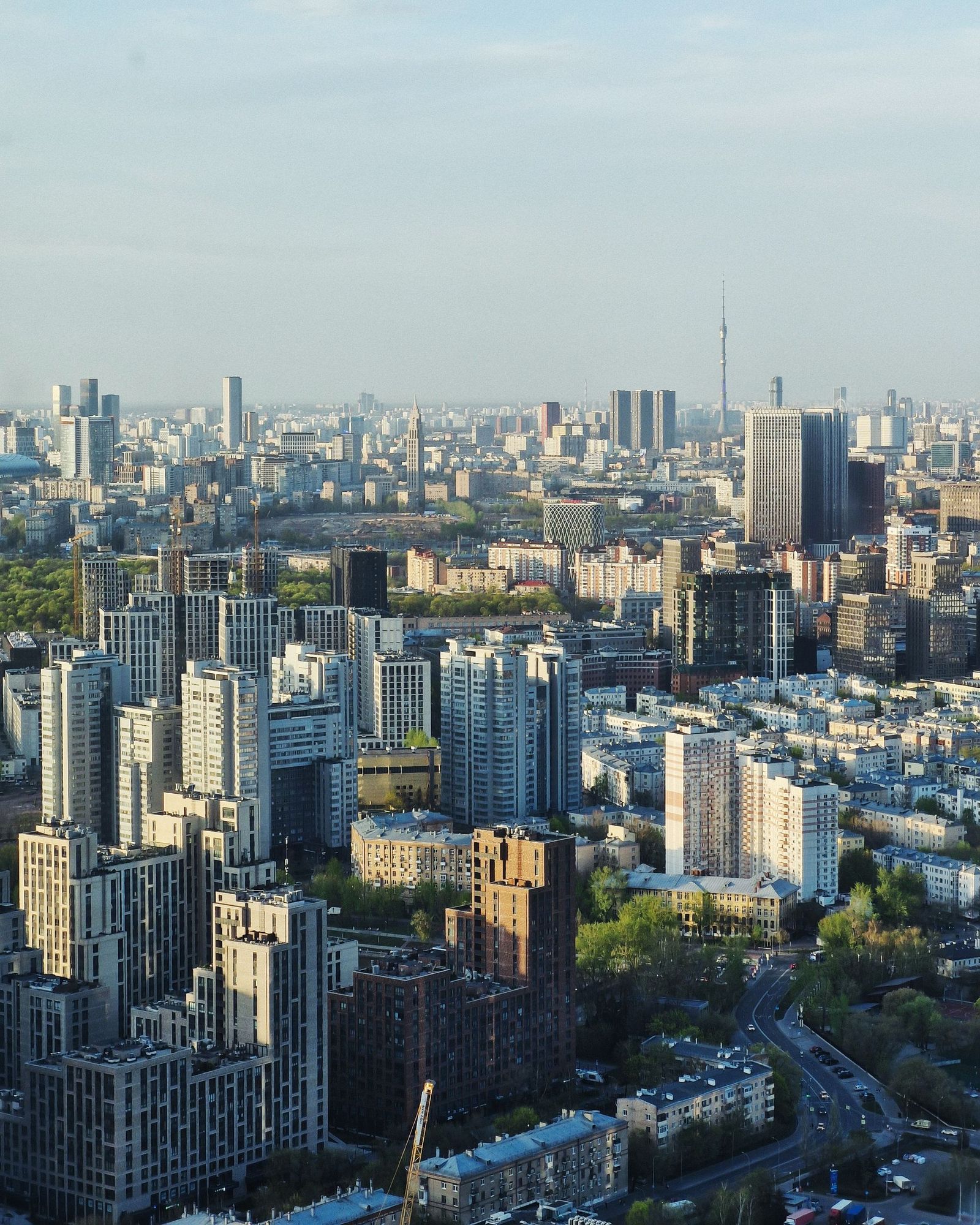
Photo: Dmitry Alexandrovich / Pexels
Interactive tool
Four Views, One Name: The Disambiguation Checklist
Check off each step as you finish it. Your progress stays on this page.
0 of 6 complete
0% done
First, the Honest Naming Problem
Google has never shipped a feature officially called Aerial View or Bird's Eye View. Bird's Eye was Microsoft's name for its oblique imagery in Bing Maps, and the term stuck in the public vocabulary long after. Google Maps offers Satellite view, the 3D Globe view on desktop, tilted 45 degree imagery in supported cities, and Immersive View for selected landmarks and routes. When a tutorial promises to show you "the aerial view in Google Maps," it is pointing at one of these four and rarely says which. Learn the four apart and every one of those tutorials suddenly makes sense, because you can tell which screen the author was looking at.
View One: Satellite, the Flat Photograph
The base layer is the one everyone has used. Switch the map type to Satellite and the map becomes a stitched photograph taken from directly overhead, flattened into the map grid. Streets, labels, and pins draw on top of it. This is the view for measuring, for checking what is actually on a plot of land, for seeing the roof, the tree cover, the pool, the new extension the listing photos skipped. Its honesty is its flatness: distances and shapes on it are map true, because nothing is tilted for effect. On both desktop and mobile it is one tap or click on the layer control, and it is the only one of the four views that exists everywhere on Earth, from city centers to farmland. When someone says "aerial view" and means "I want to see the place from above," this flat satellite layer is usually the correct destination, even if the picture looks less dramatic than the tilted alternatives.
View Two: The 3D Globe View on Desktop
On desktop, Google Maps can tilt the whole world. Enable the Globe view (in the map's settings or layers panel, depending on the current interface) and zoom into a city, and the map gains perspective: terrain rises, and in cities with 3D building data, structures stand up as extruded blocks you can orbit around by holding the control key and dragging, or with the on-screen compass and tilt controls. This is the view that feels like a flight simulator. It is genuinely useful for reading terrain, understanding which side of a ridge a road runs on, and grasping a skyline's layout. It is also the view most often mislabeled aerial view in tutorials, because it looks like footage from a low aircraft. Two cautions: the 3D buildings are models, not photographs, so fine detail is approximate; and the view leans on your graphics hardware, which is why it lives mainly on desktop. Our guide to Google Maps Street View covers the ground level partner of this view; the Globe view is what you use before you drop down to it.

View Three: The 45 Degree Tilt Imagery
In many cities, zooming far into the satellite layer used to tilt the imagery itself to roughly 45 degrees, showing building facades instead of only roofs. This oblique imagery is a real photograph taken from an aircraft at an angle, which is why it looks so different from the flat satellite layer: you see the sides of buildings, shadows fall naturally, and a street reads the way it would from a low plane window. Availability is patchy and has changed over the years as Google folded the experience into the 3D view, and on current interfaces the tilt is usually delivered through the Globe view rather than a separate switch. The practical lesson survives either way: if your satellite view suddenly shows facades, you have not broken anything, you have crossed into oblique imagery, and rotating the map rotates the angle you are viewing from. For judging a building's height, its entrances, or which side faces the street, this angled photograph beats the flat layer and the modeled 3D blocks alike, where it exists.
View Four: Immersive View, the Cinematic One
Immersive View is Google's newest answer to the aerial impulse: a rendered flythrough built from imagery and modeling, offered for famous landmarks, some routes, and selected places. It can show the time of day slider, weather, and a smooth camera path that no user gesture could produce from the raw map. It is impressive and it is also the least like a map of the four: coverage is limited to chosen places, the scene is a reconstruction rather than a live photograph, and you cannot measure on it. Reach it from the place's listing or preview card when Google offers it, usually on mobile first. Treat it as a preview and orientation aid, the trailer rather than the film. If your question is "what will this place feel like," Immersive View is the best of the four. If your question is "what is actually there," it is the worst, and the flat satellite layer wins.
Which View Answers Which Question
Match the view to the question and the confusion disappears. Checking a property, a roof, a boundary area, or construction progress: flat Satellite, because it is a true overhead photograph and it measures honestly. Reading terrain, a valley, a skyline, or how a neighborhood fits together: the desktop Globe view in 3D, because perspective is the point. Identifying a building's entrance, facade, or street presence: the 45 degree oblique imagery where available, or Street View where it is not. Previewing a famous place or a route before you go: Immersive View, accepting its limited coverage and reconstructed nature. The pattern underneath all four: the flatter the view, the more it behaves like evidence; the more cinematic the view, the more it behaves like an impression. Neither is better in general. Each is better for the question it was built to answer, and the aerial view you want is simply the one whose strengths match yours.
Availability, Dates, and Other Fine Print
Three honest limits apply to every view above. First, coverage varies: satellite imagery is universal, 3D buildings cluster in major cities, oblique imagery is a patchwork, and Immersive View is a curated list. If a view is missing for your place, the feature is not broken; the data is not there. Second, imagery has dates. The satellite photograph of a rural area may be years old, and the oblique and 3D data carry their own vintages; a new building can be absent and a demolished one present. Treat every aerial view as a photograph from the past, because that is literally what it is. Third, the interface moves. Google rearranges the layer controls regularly, so a tutorial's exact clicks age fast, while the four view concepts stay stable. Learn the concepts and you can find the current switch in seconds, whatever this year's layout does. A final practical note: on mobile, the two finger tilt gesture is the fastest route into perspective on the standard map, and the compass that appears after rotating or tilting is your reset button. One tap on it returns the map to flat, north up, and honest.
A Worked Example: The House You Cannot Visit Yet
Put the four views to work on one ordinary problem. You are considering a house across the country and cannot visit this week. Start flat: the Satellite layer shows the roof's shape and condition clues, the size of the yard, the pool the listing mentioned, the neighbor's extension looming over the fence line, and the rail line two streets over that the listing forgot. Nothing tilted would tell you more here, because the questions are about extent and adjacency, and flat photographs answer those honestly. Move to the desktop Globe view next, not for evidence but for shape: tilt the scene and the slope of the street, the way the land falls toward the creek behind the house, and the height of the ridge that will shade the garden in winter all become legible in a way the flat layer cannot convey. If oblique imagery covers the street, use it for the facade: which side the garage opens on, whether the front has the porch the photos promised. Finish at ground level with Street View for the street's actual feel. Notice what happened: each view answered the question it was built for, and no single "aerial view" would have done the whole job. That division of labor is the skill this article is really teaching.
The Mix-Ups That Waste People's Time
Three confusions recur. The first is expecting the satellite photograph to be live. It is not, in any of the four views; even the freshest layer is a capture from weeks to years ago, and the cinematic Immersive View is a reconstruction from captures, not a camera feed. The second is treating the 3D buildings as photographs. They are models: excellent for massing, shadow, and skyline, unreliable for signage, storefronts, and anything smaller than a floor. People have "confirmed" a shop's presence from its 3D block; the block proves a building, never a tenant. The third is hunting for a missing view. If the tilt does nothing in your area, or Immersive View never appears, the data does not exist there yet, and no setting, reinstall, or account trick will summon it. The mature move is to drop to the view that does exist, usually the flat satellite layer, and extract what it can honestly give. Knowing which of the four views a screenshot shows is also a quiet research skill: it tells you how much to trust what you are looking at before you act on it.
Related Guides
If this page answered part of the question, these map app guides cover the rest of the same ground:
- Google Maps Historical Imagery: Street View Dates in Maps, Satellite History in Earth: Google Maps does hold historical imagery, but only one kind: past Street View photography, reachable through the See more dates control, with an...
- Google Maps Radius Tool: How to Draw a Circle When Maps Refuses To: Neither Google Maps nor Google My Maps can draw a radius circle natively, which surprises everyone who goes looking for the button.
- How to Blur Your House on Google Maps: What It Hides, What It Never Will, and How to File the Request: Blurring your house on Google Maps is permanent, takes minutes to request, and covers far less than most people assume: Street View only, never...
- How to Hide Labels in Google Maps: The Clean Map, Desktop and Phone: Where the clean, label-free satellite view actually lives, and its limits.
Frequently Asked Questions
Does Google Maps have an official aerial view feature?
No. Google has never named a feature Aerial View or Bird's Eye View; Bird's Eye was Microsoft's term. What Google offers is the flat Satellite layer, the desktop 3D Globe view, 45 degree oblique imagery in supported areas, and Immersive View for selected places. Everyday speech calls all four aerial view, which is the source of the confusion.
How do I get the tilted view where buildings stand up?
On desktop, switch to Satellite, enable the Globe or 3D view from the layers or settings controls, zoom into a city with 3D data, and tilt using the on-screen control or by holding Control and dragging. The buildings that rise are models built from imagery, so they show massing and height well but fine detail approximately.
Why does my satellite view show building sides instead of roofs?
You have crossed into 45 degree oblique imagery, aerial photography captured at an angle rather than straight down. It appears at high zoom in supported cities. It is excellent for facades and entrances. Rotating the map changes the side you view from, and zooming out returns you to the flat overhead layer.
Is Immersive View available for my town?
Probably not, unless your town contains a famous landmark. Immersive View is curated: major landmarks, selected routes, and chosen places, mostly in large cities. Where it is absent there is no setting to enable; the flat satellite layer and Street View remain the working alternatives.
How current is the aerial imagery?
It varies by layer and by place, from recent months in major cities to several years in rural areas, and Google does not publish a per-place schedule. Treat every aerial view as a dated photograph: fine for layout and landscape, risky for anything that may have been built, demolished, or repainted since the capture.
Photo credits: Dmitry Alexandrovich (Pexels); Dmitry Alexandrovich (Pexels). Photos are served from this site; follow the credit to the library page for the original.