Glacier National Park defeats the one-map habit. The park is a million acres of the northern Rockies split by the Continental Divide into a wetter west side and a windier east, and its trailheads scatter across regions that barely connect to each other: Many Glacier in the northeast, Two Medicine in the southeast, the North Fork up a dirt road in the northwest, the Lake McDonald and St. Mary valleys at either end of the park's one famous road. A map that serves one region says little about the others, and the visitor who arrives with a single park brochure discovers the structure the slow way, at a trailhead, an hour from the sheet they needed. This guide builds the park's map stack in the order a trip actually needs it: the official map for the park's shape, the detailed regional sheets for the walking, the day-hike resource locals recommend by name, and a section on Going-to-the-Sun Road, which is a scenic drive, a logistical puzzle, and a map of its own. It follows the method of our general hiking maps guide: the authoritative source first, the detail layer second, the phone as the third opinion.
Home / Map Skills for Travel and Outdoors
Hiking Maps of Glacier National Park: The NPS Map, the Trails Illustrated Sheets, and the Sun Road
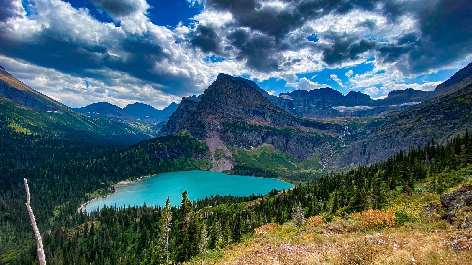
Photo: Nathan Steele / Pexels
One Park, Many Valleys: The Glacier Map Checklist
Check off each step as you finish it. Your progress stays on this page.
0 of 7 complete
0% done
Start With the Official Map: The Park's Own Portrait
The National Park Service map of Glacier is the free document handed out at entrances and downloadable from the park's site, and it earns its place as the foundation layer. It shows the park whole: the Divide, the road system, the campgrounds, the visitor centers, the boundary with Waterton Lakes National Park in Canada, with which Glacier forms the Waterton-Glacier International Peace Park. Its trail drawing is schematic rather than exhaustive, which is exactly right for its job: deciding which region a day belongs to, understanding that Many Glacier and Two Medicine are different trailheads an hour apart by road, and seeing the park's east-west structure at a glance. Print it or save it before you go, because the park will test your connectivity early and often. What the official map is not is a walking map. It will not show you the junction detail, the contour story, or the mileages a day on the Highline or the Grinnell Glacier trail demands, and nobody should navigate a Glacier backcountry route from it. That is the next layer's work, and the division is the same one this site teaches everywhere: the authority's map for the shape of the place, the specialist's sheet for the ground under your boots.
The Detail Layer: Trails Illustrated, One Sheet per Region
For the walking itself, the standard is the National Geographic Trails Illustrated series, topographic sheets drawn for hikers, waterproof and tear-resistant, with trails, contours, trailheads, and backcountry campsites at a scale a day hike can be navigated from. Glacier takes several sheets because the park is several places. The listings name sheet 215, Glacier and Waterton for the park's core, 313, North Fork for the wild northwest corner, and 315, Two Medicine for the southeast region, with the set together covering the park's walking country. The practical move is to buy or borrow the sheet for the region your hikes actually occupy, which means deciding the region before the sheet, the official map's job, rather than expecting one sheet to cover a park that spans a divide. Many Glacier's trails, the Grinnell and Swiftcurrent country, live on the core sheet; Two Medicine's quieter network, which many repeat visitors call the park's best walking, needs its own. A sheet per region sounds like a sales pitch until the first afternoon a trail junction offers two unmarked choices and the sheet in your hand, drawn for this valley, settles it. Paper earns its pack space in Glacier the old way: the phone dies, the sheet does not, and the Divide's weather does not care about your battery.

Day Hikes by the Map: The Local Shortcut
Glacier's day hiking has an institution worth knowing by name: Hike 734, the day-hike project built by a local hiker who walked the park's day routes and published them as a map-guide, covering 88 day hikes with the trailheads, distances, and honest difficulty judgments that a regional sheet alone does not give. Its value is selection rather than navigation: the Trails Illustrated sheet shows every trail with democratic equality, while a day-hike guide answers the visitor's real question, of the hundred lines on this sheet, which eight fit my legs, my day, and my region. Use the two together, the guide to choose, the sheet to walk, and the combination reproduces how locals actually plan. The park's famous days reward the choosing: the Highline from Logan Pass, Grinnell Glacier in Many Glacier, Siyeh Pass, the lakes of Two Medicine, each in a different region with a different sheet, which is why a Glacier trip is planned region by region and day by day rather than from a single bucket list. Trail conditions, bear closures, and snow on the passes change the answer weekly in season, and the park's own alerts, checked at a visitor center or on the park site when you have signal, outrank any printed guide, this one included.
Going-to-the-Sun Road: A Map Problem of Its Own
The park's one through road deserves its own paragraph in any map guide because it behaves like a hike: seasonal, weather-bound, and planned in advance. Going-to-the-Sun Road runs about 50 miles from West Glacier to St. Mary, climbing the west side's forests, crossing the Divide at Logan Pass, and descending the east side's open country, and for most visitors it is the trip's spine, the drive that connects the regions and delivers the Logan Pass trailheads. It opens only when the snow clearing allows and closes when the snow returns, which makes it a feature with a season rather than a road with a schedule; the park publishes its status, and no itinerary should treat the crossing as guaranteed until the park says so for your dates. Vehicle size restrictions apply on its narrower sections, another fact to take from the park's current pages rather than from any guide's memory. On the map, the road teaches the park's essential lesson in one drive: west side and east side are different climates sharing a border, the Divide is a wall the road crosses at exactly one pass, and when the road is closed, the regions it connects become separate trips. Plan the drive as you would a summit day, with a map, a weather eye, and a plan B in the region you are already in.
The pass itself concentrates the park's day hiking at Logan Pass, where the Highline and Hidden Lake trails begin at the top of the road, and that concentration has a practical consequence the map cannot show: the parking there is the park's most contested ground, gone early on fine days, so the drive's timing is part of the hike's planning. Arrive early, or ride the park's shuttle from the valley visitor centers and let the road be scenery instead of a parking contest. Either way, the Sun Road rewards being treated as a destination rather than a commute: its pullouts, its waterfalls beside the pavement, its engineering on the cliff face are the park's most accessible wonders, and the map's job is to slow you down for them, not to hurry you across.
Offline or Nothing: Signal, Paper, and the Divide
Cell service in Glacier is a rumor in most of the park and a memory at many trailheads, so the phone layer of your map stack must be downloaded before the park, trail maps, the park map, and this guide's region sheets photographed or saved, while you still have the towns' signal. The apps that serve hikers elsewhere serve here too as the third layer, position checks and downloaded routes, under the doctrine of our trail maps guide: the official and printed sources define the ground truth, the phone tells you where on it you are standing. What the phone cannot do is rescue a trip planned on the assumption of live data: the trailhead you cannot find because the search needs signal, the closure notice that never loaded. Paper closes the system. The official map for the park, the Trails Illustrated sheet for the region, and a downloaded phone map together weigh almost nothing and fail almost never, in a park whose weather, wildlife, and distances punish improvisation. Glacier rewards the prepared with some of the finest walking on the continent. Its map stack is how the preparation starts.
The Backcountry Layer: Campsites, Permits, and the Map After Dark
Day hikers meet the park in daylight and leave; backpackers live in its map for a week, and their layer adds two features the day stack treats lightly. The first is the backcountry campsite system: designated camps strung along the park's trail network, drawn on the Trails Illustrated sheets at their true positions, because in Glacier you camp where the system says, in bear country, by design rather than by preference. A route is therefore planned campsite to campsite, the distances between designated nights dictating the days, and the sheet that shows them all is the planning table for the whole enterprise. The second is the permit: Glacier's backcountry camping runs on a reservation and permit system administered by the park, and the permit, with its named camps and dates, becomes part of the map packet, the document that says where you are allowed to be found each night. Rangers plan rescues from it; weather decisions are made against it; it is, functionally, part of the map. The day hiker needs none of this machinery and should know it exists anyway, because the trails they walk are the same trails, and the camps they pass are the visible edge of the system. Glacier's map stack, official sheet, regional sheet, day-hike guide, and for the overnight traveler the permit, is the park's whole philosophy in paper form: a wild place, carefully known.
Related Guides
The closest companions to this guide are the travel and outdoors map skills guides below. Each one picks up a thread this page starts:
- Hiking Maps of Washington State: The WTA Hike Finder, Green Trails Sheets, and Three National Parks: Washington holds three national parks, a wall of national forests, and the best volunteer trail organization in America, and its maps reflect all...
- Hiking Maps of the Dolomites: The Tabacco Sheets, the CAI Numbers, and the App: The Dolomites are the rare mountain range with a single obvious map answer: the 1:25,000 sheets of Casa Editrice Tabacco, numbered, ruthlessly...
- Hiking Maps in the UK: OS Explorer vs Landranger, Harvey Sheets, and Grid References: Britain is the most thoroughly mapped walking country on earth, and its system is paper at heart: Ordnance Survey sheets at two scales, Explorer...
- Hiking Maps Near Me: Find Trails Worth Walking, Starting From Your Own Door: Near me is the most honest search in hiking and the worst served, because the trail five miles from your door is invisible to the...
- Trail Maps of Colorado: COTREX, USGS Quads, and the Official Layers: state-scale trail mapping beyond the parks
- Trail Maps of Acadia National Park: The Carriage Road System and Its Own Map: The other park with a famous road and its own map logic: carriage roads instead of a sun road.
Frequently Asked Questions
What is the best map for hiking in Glacier National Park?
Start with the free National Park Service map for the park's structure, then walk with the National Geographic Trails Illustrated sheet for your region: 215 for Glacier and Waterton's core, 313 for the North Fork, 315 for Two Medicine. No single sheet covers the whole park at hiking detail, because the park is several regions split by the Divide.
Which region of Glacier should I base in?
Many Glacier has the densest famous day hiking, Two Medicine is quieter with superb walking, the Lake McDonald and St. Mary valleys anchor the two ends of Going-to-the-Sun Road, and the North Fork is the wild, remote corner. Your map choice follows the region, so decide the base first, then buy that region's sheet.
Is Going-to-the-Sun Road always open in summer?
No. It opens when snow clearing allows and closes when conditions demand, and its season is set by the park each year. Vehicle size restrictions also apply on sections. Check the park's current road status for your exact dates and plan a version of the trip that works if the crossing is closed.
Does my phone work in Glacier?
Assume not. Service is patchy to absent across most of the park and at many trailheads. Download every map layer before entering, and carry the paper sheets for your region. Treat any signal you do get as a bonus for checking the park's alerts, not as part of the navigation plan.
What is Hike 734?
A day-hike map-guide project by a local hiker covering 88 of the park's day hikes, with trailheads, distances, and difficulty judgments. Use it to choose which hikes fit your day and region, and the Trails Illustrated sheet to navigate them. It complements the topographic sheets rather than replacing them.
Photo credits: Nathan Steele (Pexels); Colon Freld (Pexels). Photos are served from this site; follow the credit to the library page for the original.