Most mountain ranges leave the walker to assemble a map answer from competing publishers and platforms. The Dolomites, the pale rock ranges of South Tyrol, Trentino, and the Veneto, settled the question generations ago. One publishing house, Casa Editrice Tabacco of Udine, has mapped these mountains since the years after the Second World War, and its 1:25,000 hiking sheets are so completely the local standard that guides call them simply "the maps," the Alpine rescue services navigate by them, and the trail numbers printed on them are the same numbers painted on the rocks. This guide is a user's manual for that system: how the numbered sheets divide the range, how to read what a Tabacco sheet is telling you, how the publisher's own app carries the same cartography onto your phone, and how the range's great multi-day routes, the Alte Vie, stress the system in ways a day walk never does. For the wider European stack this range sits inside, see our best hiking map app for Europe; for the reading skills every sheet assumes, our guide to reading a map for hiking is the place to build them.
Home / Map Skills for Travel and Outdoors
Hiking Maps of the Dolomites: The Tabacco Sheets, the CAI Numbers, and the App
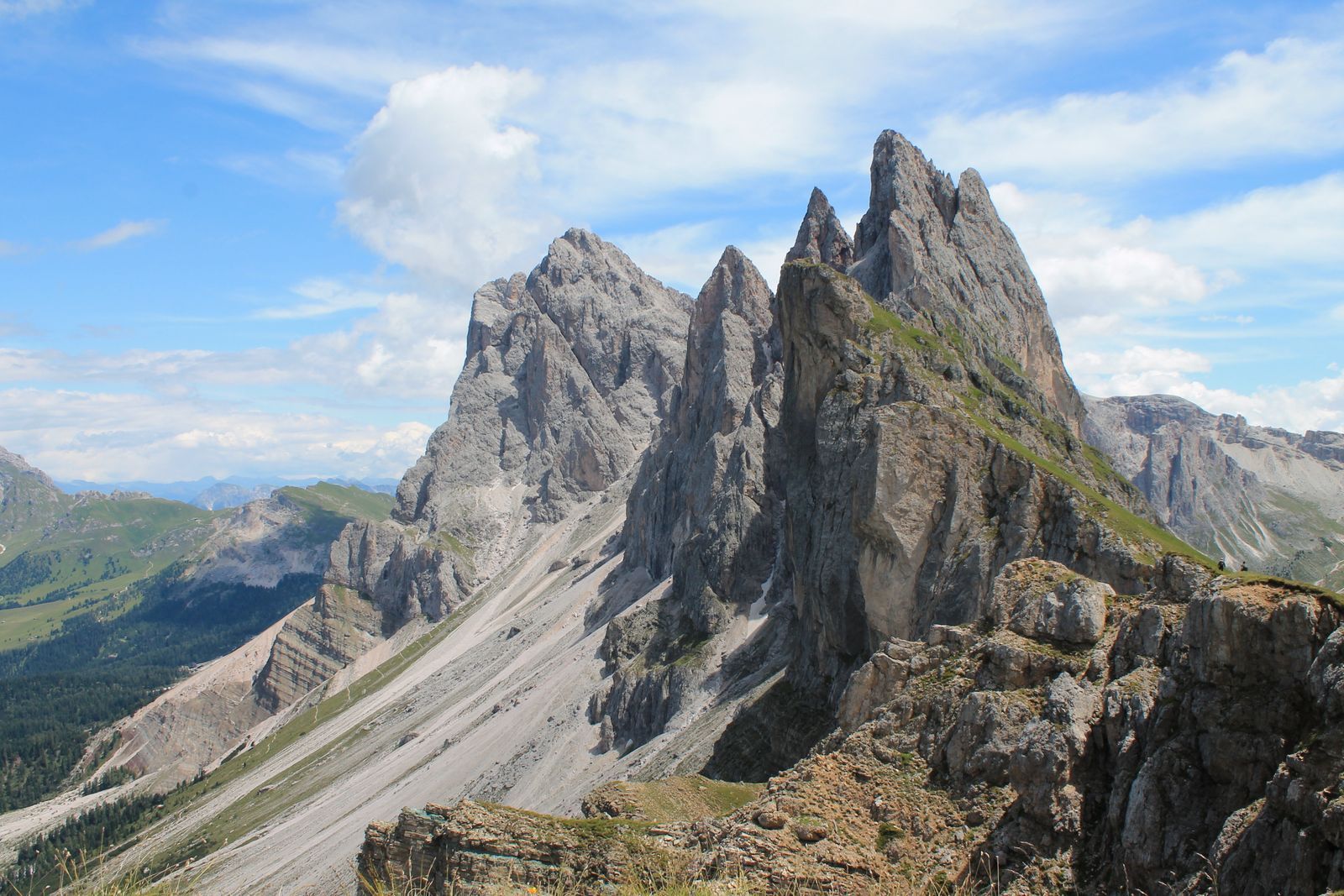
Photo: Roberto Baciga / Pexels
One Numbered Language: The Dolomites Map Checklist
Check off each step as you finish it. Your progress stays on this page.
0 of 8 complete
0% done
The Tabacco Sheets: One Range, One Numbered Library
Tabacco divides the eastern Alps into a library of numbered sheets, each covering a named group of mountains at 1:25,000, the walking scale at which a sheet can draw every path, rifugio, lift, and contour with room to spare. The Dolomites occupy a run of these numbers, and regulars cite sheets the way skiers cite pistes: sheet 07 for Alta Badia, 015 for the Marmolada group, 022 for the Pale di San Martino, 023 for the Alpi Feltrine, 030 for the Bressanone and Val Pusteria country, with neighboring numbers filling the rest of the range. Finding your sheet is a two-minute job: the publisher's index shows each number's footprint over the range, and any mountain bookshop in Cortina, Ortisei, or Canazei stocks the local sheets as a matter of course. What makes the sheets the standard is not availability but fidelity. They are revised from the territory itself, they show the rifugi, the staffed mountain huts that structure Dolomite walking, in their true positions, they draw the vie ferrate, the protected climbing routes, distinctly from walking paths, and their contour and rock drawing renders the Dolomites' strange vertical architecture, meadows that end at walls, legibly enough to navigate by. A walker carrying the right Tabacco sheet carries the range's own portrait of itself, and every other map product for the Dolomites is best understood as a commentary on that portrait.
The CAI Numbers: Where the Paper Meets the Painted Rock
The feature that elevates the Tabacco sheets from excellent maps to a navigation system is a number. Italy's trails are maintained by the Club Alpino Italiano, the CAI, through its local sections, and every official trail carries a number, painted on signposts and on the red-and-white waymarks that stripe rocks and trees along the path. Tabacco prints those same numbers along the trails on the sheet. The consequence is a closed loop between paper and ground that few mountain regions match: stand at a junction, read the signpost's numbers, find the same numbers on your sheet, and you know not approximately but exactly which line on the map you are standing on and where each departing path is certified to go. The CAI also classifies its trails by difficulty, a graded scale running from easy tourist paths through hiking trails to routes for expert hikers and the equipped ferrata grades, and the sheet's symbology reflects that hierarchy, so the map quietly warns you where a walking line becomes a climbing undertaking. Learn to use the loop deliberately. Navigate junction to junction by numbers rather than by dead reckoning, confirm each number on the sheet before committing to a descent, and treat any path on the ground that carries no number as what it is, an unofficial line, a hunters' track, a shortcut to someone's meadow, that the system makes no promise about. In the Dolomites, the map and the mountain are kept in agreement by an army of volunteers; the walker's whole job is to read both sides of the agreement.

TABACCOmapp: The Same Cartography on Your Phone
The publisher's official app, TABACCOmapp, carries the digital edition of the same sheets onto the phone, and its proposition is continuity rather than novelty: the map on your screen is the map in your pack, same drawing, same numbers, same symbols, with a GPS dot standing on it. The digital sheets are obtained for the areas you need rather than as one continental download, mirroring the paper library's logic, and once obtained they work offline, which in the high Dolomites is not a preference but the operating condition. Used well, the app changes the rhythm of a walk rather than its substance. Position checks that once meant unfolding a sheet in the wind become a glance; the sheet stays folded for the morning's planning and the evening's review, the two moments when the big picture is the point. Used badly, as a replacement for the sheet rather than its companion, it inherits every phone failure mode at altitude, battery, glare, cold, and the Dolomites are tall enough to punish all three in an afternoon. The local doctrine, visible in any rifugio dining room, is the hybrid: paper as the primary document, phone as the position instrument, each covering the other's weakness. It is the same doctrine British walkers apply to their OS sheets, arrived at independently in a different range, which suggests it is less a fashion than a law of mountains.
The Alta Via Problem: Five Sheets for One Walk
Day walks live inside one sheet. The Dolomites' signature journeys do not. The Alte Vie, the high routes that traverse the range hut to hut over a week or more, Alta Via 1 down the eastern spine, Alta Via 2 across the western groups, cross sheet boundaries as casually as they cross valleys. An Alta Via 2 walker can need sheets 030, 07, 015, 022, and 023 to hold the whole line on paper, a small atlas in the pack, and even then the route threads the edges and corners of sheets in the way that maximizes unfolding. This is where the digital layer stops being a convenience and becomes the structural answer: in the app, and in planning platforms like Komoot and Outdooractive where the Alte Vie are published as complete routes, the line is continuous, the sheet boundaries vanish, and the whole traverse can be downloaded as one offline object. The mature setup for a high route uses each medium at its strength. Plan the traverse in the platform, where stages, rifugi, and variants compose into days. Carry the digital sheets offline for position. And carry the paper for the sections where the walk is serious, because the overview a sheet gives of tomorrow's terrain, the bail-out descents, the weather alternatives, has no phone-sized equivalent. Guidebooks, Cicerone's above all, supply the narrative layer, stage descriptions and timings, that neither sheet nor app attempts. A Dolomites traverse is a small library pretending to be a walk, and it rewards the walker who packs it deliberately.
Kompass, Planners, and the Rest of the Shelf
Tabacco's dominance is not total, and a complete guide should name the alternatives honestly. Kompass, the Austrian publisher, maps the Dolomites in its own hiking series, paper and digital, and walkers crossing from the Austrian side sometimes arrive carrying it; it is a competent portrait of the same ground, and the choice between the two is mostly about which drawing hand you learned on, though the CAI number fidelity and the local revision culture keep Tabacco the reference in the Italian valleys. The global planners earn their place one layer up: Komoot and Outdooractive hold the community's route knowledge, the classic day loops, the viewpoint detours, the honest timings, and Gaia-style GPS apps serve walkers who navigate by imported tracks. The CAI's own digital projects, including the Sentiero Italia mapping of the great Italian traverse, extend the official system into digital form. None of these replaces the sheet; each annotates it. That is the final shape of the Dolomites answer, and it is simpler than most ranges offer: one authoritative map, in paper and in its own app, a numbered trail system that binds map to ground, and a shelf of planners and guidebooks that build journeys on top. Learn the sheet first. Everything else in the system is commentary.
Paper or App on the Day: The Working Compromise
The walker's last decision is the morning's: what actually gets carried. The Dolomites answer, visible in any rifugio, is layered rather than loyal. The sheet goes in the pack for the walk's serious ground, the high passes, the junctions above the treeline, anywhere a wide view of the terrain is a safety instrument, and it doubles as the evening's planning table for tomorrow. The app runs the day's ordinary navigation, the forest paths, the valley links, the quick position checks, where its convenience is pure profit. Light summer days on waymarked valley trails can honestly go app-only, and locals do; the rule is not that paper is compulsory but that its absence should be a decision, made with the day's altitude and weather in view, rather than a default set by a dead battery. However you compose it, compose it the night before, in the rifugio, over the sheet itself. The Dolomites reward the planned like few ranges on earth, and their map system, paper and digital in one numbered language, is built to make planning the pleasure it should be.
Related Guides
The closest companions to this guide are the travel and outdoors map skills guides below. Each one picks up a thread this page starts:
- Hiking Maps of Glacier National Park: The NPS Map, the Trails Illustrated Sheets, and the Sun Road: Glacier is not one valley but a small mountain kingdom split by the Continental Divide, and its maps divide the same way: a free official park map...
- Hiking Maps in the UK: OS Explorer vs Landranger, Harvey Sheets, and Grid References: Britain is the most thoroughly mapped walking country on earth, and its system is paper at heart: Ordnance Survey sheets at two scales, Explorer...
- Hiking Maps of Washington State: The WTA Hike Finder, Green Trails Sheets, and Three National Parks: Washington holds three national parks, a wall of national forests, and the best volunteer trail organization in America, and its maps reflect all...
- Hiking Maps Near Me: Find Trails Worth Walking, Starting From Your Own Door: Near me is the most honest search in hiking and the worst served, because the trail five miles from your door is invisible to the...
Frequently Asked Questions
What is the best hiking map for the Dolomites?
The 1:25,000 sheets published by Casa Editrice Tabacco. They are the range's standard map, used by guides and Alpine rescue, revised locally, and drawn to match the CAI's numbered trail system. The publisher's TABACCOmapp app carries the same sheets digitally for offline use.
How do I know which Tabacco sheet I need?
Each sheet is numbered and named for its mountain group: 07 covers Alta Badia, 015 the Marmolada, 022 the Pale di San Martino, 023 the Alpi Feltrine, 030 the Bressanone area, and so on. The publisher's index map shows every sheet's footprint; match your base or route against it.
What do the numbers on Dolomites trails mean?
They are the Club Alpino Italiano trail numbers. The same numbers appear on signposts and red-and-white waymarks on the ground and along the trails printed on Tabacco sheets, so you can identify exactly which mapped line you are standing on at any junction.
Can I rely on my phone alone in the Dolomites?
The official app works offline once its sheets are downloaded, and it is excellent for position checks. Local practice still pairs it with the paper sheet, which cannot run out of battery and gives the wide overview planning needs. At altitude, treat the phone as the instrument and the paper as the document.
Which maps do I need for Alta Via 2?
On paper, the traverse crosses about five Tabacco sheets, including 030, 07, 015, 022, and 023. Digitally, the route is published as one continuous line in platforms such as Komoot and Outdooractive and can be downloaded whole, which is why most Alta Via walkers plan digitally and carry paper selectively.
Photo credits: Roberto Baciga (Pexels); Nicola Toscan (Pexels). Photos are served from this site; follow the credit to the library page for the original.