Reading a map is a skill with an order to it. Hand an unfamiliar map to an experienced navigator and you will watch the same five moves happen in the same sequence, every time, whether the map is a paper trail sheet or a screenshot on a phone. This guide teaches those five moves as one routine you can memorize: margin, orient, legend, scale, land. By the end you will run the full routine on a real example, the Grand Canyon, and measure it two ways: with the paper-strip method that works when batteries die, and with the Distance Measurer on this page.
This is the general lesson. The deep dive on one family of maps, the topographic sheets whose brown contour lines describe hills and valleys, lives in how to read a topographic map, and the scale gets its own full treatment in map scale. Start here; those are the sequels.
Interactive map
Distance Measurer
Click the map to drop numbered points. The line between them is measured as the crow flies, with the bearing of each leg.
Every proper map carries its instructions around its edges, and beginners skip them because the middle looks more interesting. Read the margin first. You are looking for five things: the title, which names the area and the map's purpose; the date, because maps age and a decade-old sheet may miss the new road and the closed trail; the scale, in words, numbers, or a bar; the legend or key, the dictionary of its symbols; and the north arrow or grid, which tells you which way is up in the map's own terms, not always the top of the page.
On a phone, the margin hides in menus: the map's source and date sit in an about or attribution line, the legend behind a layers button, and the scale bar appears as you zoom, if the app shows one at all. The move is the same; only the hiding places differ. Thirty seconds in the margin prevents the classic beginner failure, which is navigating confidently from a map whose date, scale, and symbols were never checked.
Move Two: Orient the Map
An oriented map points the same way as the world. Turn the paper, or rotate the phone view, until the map's north matches real north and the features around you line up with their symbols: the road ahead of you runs up the page, the river on your left is on the map's left. Orientation sounds trivial and is the single biggest upgrade a beginner can make, because an oriented map lets your eyes do the work your brain otherwise does slowly and wrongly, translating between the page's directions and the world's.
To orient with a compass, set the compass on the map, turn map and compass together until the needle and the map's north agree, and leave the map lying that way while you work. Our how to use a compass guide teaches the instrument itself. On a phone, the compass mode or the blue cone of your location does the same job; the failure to avoid is the phone's default north-up lock while you walk a winding trail, forcing you to rotate the world in your head at every bend.
Move Three: Decode the Legend
The legend is the map's dictionary, and the routine is: never guess a symbol you can look up. Colors carry the first layer of meaning on nearly every map: blue is water, green is vegetation or parkland, brown is relief and contour, black is built and named things, red and orange are important roads. Lines carry the second: solid versus dashed versus dotted usually separates the permanent from the seasonal, the road from the trail, the boundary from the path. Point symbols, the small icons for summits, springs, campsites, and stations, are the least standardized and the most worth checking in the key itself.
The transferable skill is not memorizing one map's symbols; it is reading any legend in under a minute. That skill has its own full guide: map legend symbols teaches the one-minute routine and the decoder tables for both topographic and OpenStreetMap conventions.
Move Four: Judge Distance With the Scale
A map you cannot measure is a story, not a tool. The scale converts page distance to ground distance, and it comes in three costumes: a verbal scale (one inch equals one mile), a ratio (1:24,000), and a bar scale, the printed ruler that survives photocopying and zooming. For field use, the bar is king, and the paper-strip method is how you use it on a winding route:
Lay the edge of a strip of paper along your route on the map, making a tick at the start.
Walk the strip along the route bend by bend, pivoting at each turn and ticking where each straight piece ends, so the strip accumulates the route's true length rather than the straight-line shortcut.
Lay the finished strip against the bar scale and read the total distance directly.
Now practice the digital twin of that skill in the tool on this page: click the same kind of route point by point and watch the distance accumulate. The tool measures straight segments between your clicks, exactly as the strip does, so click at every bend. Two honest warnings belong here. A measured distance is the map distance; real legs add climb, detour, and surface, so walkers should treat the number as the floor of the effort, not the ceiling. And a straight line between two points, the as-the-crow-flies figure, is a different answer from the route distance, useful for radio range, weather, and orientation, useless for how far your boots will travel.
Move Five: Read the Land
With the mechanics handled, read the map as a description of a place. Valleys announce themselves by the water in them and by contour lines pointing upstream in Vs; ridges by contours pointing downhill and by the paths that follow them, because people and animals both prefer ridge lines to swamps. Settlements cluster where water, flat land, and routes meet. A road that switchbacks is confessing a steep slope; a trail that contours is promising an easy grade. This move is the one that grows with practice, and the topographic guide takes it deepest, but even a beginner reading a simple trail map can ask the three questions that start it: where is the water, where is the high ground, and where would I walk if I were drawing this route with my feet?
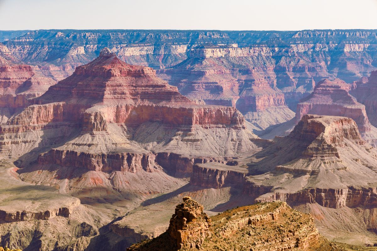
The Grand Canyon seen from its rim
The Full Routine, Worked: Grand Canyon
Run all five moves on one example. The map in front of you is a trail map of the Grand Canyon's South Rim area.
Margin. Title: Grand Canyon, South Rim. Date: recent edition. Scale bar in miles and kilometers. Legend includes trail, rim road, viewpoint, water, and contour symbols. North arrow points up the page.
Orient. You are standing at the South Rim Visitor Center. The canyon lies to the north, so with the map's north up, the canyon should fill the top of the sheet, and it does; the map and the world agree.
Legend. The dashed brown line is the rim trail; the solid line is the rim road; blue marks the Colorado River at the canyon's floor; the viewpoint symbol marks the rim overlooks.
Scale. Your question: how far is the North Rim, straight across? The strip method fails here, there is no route across the void, so measure the straight line: on the map it spans a distance the bar scale reads as about 17.7 km (11.0 mi). The Distance Measurer on this page, clicked from the South Rim Visitor Center at 36.061900, -112.107700 to the North Rim, confirms it: 17.7 km (11.0 mi), on a bearing of 13.4 degrees, just east of north. The road journey between the same two rims is roughly five hours around the canyon's eastern end, which is the finest illustration in this article of why straight lines and routes are different answers.
Land. The contours crowd at the rims and spread on the plateaus; the river's blue thread sits at the bottom of a mile of relief; every trail from the rim descends steeply because the land leaves it no choice. The map has told you the canyon's whole character before you take a step: crossable by eye in seconds, by road in hours, by foot in days.
Paper and Phone: What Changes, What Does Not
The routine survives the medium. What changes is where things hide and what fails. Paper never runs out of battery and never loses signal, and it shows the whole sheet at once, which is why experienced navigators still carry it for serious country; its failures are age, weather, and the zoom you cannot do. The phone zooms, locates you on the map with satellites, and updates; its failures are battery, signal for fresh data, and a screen that shows a keyhole view of the country, tempting you to navigate bend by bend with no sense of the whole. The professional answer is both: the phone for position and detail, the paper for the overview and the bad day. The five moves apply identically to each, which is the point of learning a routine instead of a device.
Common Beginner Errors
Error
What happens
The fix in the routine
Skipping the margin
You navigate from an old, misread, or wrong-area map
Move one: margin first, always
Reading the map upside down relative to the world
Left and right swap in your head at every junction
Move two: orient before interpreting
Guessing symbols
A seasonal track becomes a road in your plan
Move three: the legend outranks memory
Measuring straight lines for routes
The walk is twice the estimate
Move four: strip method along the bends
Trusting the phone's keyhole view
No sense of the whole valley or the escape routes
Zoom out for the overview; carry the paper sheet
Grid References: The Map's Own Address System
One more margin resident deserves a paragraph, because it completes the beginner's toolkit: the grid. Many paper maps carry a printed grid of squares, each labeled with letters or numbers along the edges, so any point can be named as a grid reference: the square, then the position within it, eastings before northings in the classic systems. A grid reference is a street address for a point on that sheet: coarse at four figures, naming a square; precise at six, naming a spot inside it. Phone maps replaced the habit with coordinates, the global grid taught in our latitude and longitude article, but the paper skill still matters wherever rescue services, guidebooks, and trail signs speak in grid references, and the translation instinct is the same: a reference is useless until you know which grid, which is the margin's job, which is move one's job. Notice how the routine keeps paying for itself.
Related Guides
This guide does not stand alone. The travel and outdoors map skills guides below take up the questions it leads into:
The margin: title, date, scale, legend, and north indicator. Thirty seconds there tells you what the map covers, how old it is, and how its symbols and distances work, before you interpret a single feature.
How do I orient a map without a compass?
Use the land. Find two features you can see and identify on the map, a road junction and a hill, a river bend and a bridge, and turn the map until the line between their symbols points the way the line between the real features points. The sun helps too: in the northern hemisphere it is roughly south at midday.
What is the paper-strip method?
Measuring a winding route by accumulating its length along the edge of a paper strip, bend by bend, then reading the strip against the bar scale. It converts any route on any paper map into a true distance with no electronics, and the Distance Measurer on this page is its digital twin.
Why is the straight-line distance not the walking distance?
Because routes bend, climb, and detour around obstacles the straight line ignores. The Grand Canyon example in this article is the extreme: 17.7 km straight across, about five hours by road. Always measure along the route for travel time, and use straight lines only for orientation and range.
Can I learn to read a map on my phone alone?
Mostly, yes: the five moves are identical, and the phone adds your live position. Add one paper session if you can, because the whole-sheet overview teaches the land-reading move faster than a zooming screen does, and paper is the backup when the phone dies.
What map should a total beginner start with?
A trail map of a park you know, or the map of your own town. Familiar ground lets you check every move against reality: you already know where the river and the high street are, so the map's way of drawing them teaches you the language without the risk of being lost while you learn.
Photo credits: Tima Miroshnichenko (Pexels); Igor Passchier (Pexels). Photos are served from this site; follow the credit to the library page for the original.