Offline Maps: What They Are, How They Work, and When You Need Them
By the Osm4People editorial team
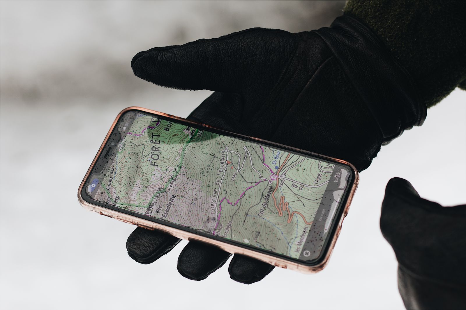
Photo: Maël BALLAND / Pexels
An offline map is a map that lives on your phone instead of arriving through the network. You download a region while you have a connection, and from then on the phone draws the streets, searches its own stored copy, and routes you through it with no signal at all. It sounds like a small feature. On a mountain road, in a foreign city on arrival day, or in the dead zone between two towns, it is the difference between a map and a gray grid.
This article is the explainer: what an offline map actually is, the two halves that make it work, what is inside a download, and what stops working when the signal dies. If you already know you want one and just need the taps, our step guide to how to download offline maps is the companion to this page. Read this one first if the idea itself is fuzzy, because understanding the mechanism tells you which app's offline claim to believe.
Interactive map
Distance Measurer: Size the Area Your Download Must Cover
Click your start point, your destination, and the detours you might take. The total line is the corridor your offline download has to contain, with margin on every side.
The Two Halves: Stored Data and Satellite Position
Every map on your phone is really two systems pretending to be one.
Half one: the map data. Streets, names, addresses, paths, and places have to come from somewhere. Online, they stream from a server as you pan. Offline, they were copied onto your phone earlier, while you had Wi-Fi, and they sit in storage waiting.
Half two: your position. The blue dot does not come from the network at all. Your phone listens to navigation satellites directly, and works out where it is from the timing of their signals. That receiver works in airplane mode, in a tunnel-free desert, and over the ocean, because it never needed the cell network in the first place. Our full explainer on how GPS works walks through the satellite side in plain language.
Put the halves together and the mystery dissolves. An offline map works because the only part that ever needed the internet was the picture, and you brought the picture with you. The positioning half keeps working because it was never online to begin with. This is also why a phone with no SIM, or a tablet with no cell radio at all, can still navigate offline perfectly well once it carries the data.
What Is Inside a Download
Download a region and you receive a package of map data for that rectangle or that country: road geometry and names, turn restrictions, addresses in the better implementations, places of interest, and, in the trail-capable apps, footpaths and contour information. Two storage technologies hide under the same word download, and the difference explains file sizes.
Vector data stores the map as geometry and labels: this road runs from here to here, this building has this outline, this label sits at this point. The phone draws the picture fresh at every zoom. Vector packages are small, stay sharp at all zooms, and let the app reroute and search fully offline. Google Maps, Apple Maps, and the OpenStreetMap apps all use vector data in their own formats.
Raster data stores the map as pre-drawn picture tiles, like photographs of a paper map at each zoom level. Raster looks exactly like the printed original, which some hikers love, but the files are heavy and the phone cannot search or reroute inside a photograph. You meet raster mostly in specialist topographic apps that mirror official paper sheets.
The practical consequence: a whole country in vector form can be smaller than one city in raster form. When an app quotes a surprisingly small download, it is vector; when a topo app quotes gigabytes, it is raster, and both are telling the truth about different things.
What Works and What Stops
Offline does not mean everything works. It means the stored half works and the live half stops, and the boundary sits in a slightly different place in each app.
Feature
Google Maps offline
Apple Maps offline
Offline-first apps (Organic Maps, OsmAnd)
See the map and your position
Yes
Yes
Yes
Search for places in the area
Yes, from stored data
Yes, from stored data
Yes
Driving directions
Yes, inside the area
Yes, inside the area
Yes
Walking and cycling directions
No, driving only
Yes in supported regions
Yes
Public transit directions
No
Yes in supported cities
Basic, from stored schedules where present
Live traffic and rerouting around jams
No
No
No
Fresh reviews, photos, busy times
No, saved snapshot only
No
No
Places outside the downloaded area
No
No
Only if that country is downloaded
Read the Google column carefully if you walk or ride transit: inside Google Maps, offline directions are driving directions. Walkers and transit riders are the people most often stranded by that footnote, and they are exactly the people our best offline map app guide steers toward the offline-first apps or Apple Maps in supported cities.
Expiry, Updates, and Storage
Downloaded maps go stale, and each app handles the decay differently. Google Maps offline areas expire, typically after about a year, and the app nags you to refresh them; turn on automatic updates over Wi-Fi and they quietly stay fresh. Apple Maps downloads persist but age the same way in practice: a new bypass does not exist in last year's package. The OpenStreetMap apps update their country files roughly monthly, and updating is a tap when you are back on Wi-Fi.
Storage is the other quiet limit. A city region might take a few hundred megabytes; a large country in a vector app can take one to three gigabytes; raster topo tiles for a mountain range can take far more. Before a trip, download on Wi-Fi and check the total against your free space, because the failure mode is discovering at the trailhead that the last region never finished. The checklist in our how to download offline maps guide includes the storage check for exactly this reason.
Sizing an Area: The Corridor Problem
The classic beginner mistake is downloading the destination and nothing else. Your route is a line, and the download must contain the line plus margin for detours, closures, and the fuel stop two towns over. Think in corridors, not points.
Worked example: New York to Boston. The straight line between the two city centers, measured with the tool on this page, is 306.1 km (190.2 mi), and the road distance is longer. A download that must serve the drive has to cover that whole corridor with width to spare, which in Google Maps means several overlapping rectangles along the route, and in a country-based app means the states the corridor crosses. Use the Distance Measurer above before you download anything: click your start, your destination, and your likely detours, and the total line tells you the shape your downloads must cover. Then double the width in your head for the detour you have not thought of yet.
A backpacker holds a paper map open in front of a mountain landscape
When You Actually Need One
You need an offline map when any of these is true. You are traveling internationally without a data plan or before a local SIM is sorted. You are driving rural country where coverage maps lie and dead zones are measured in counties. You are hiking, where the trail leaves the network long before it leaves the map. You are visiting a city with expensive roaming and a subway system that swallows signal. Or you simply want insurance: even at home, networks fail in storms, disasters, and stadium crowds, and the downloaded map does not care.
You can skip it when your travel is one connected city, your plan includes data, and getting lost costs you ten minutes rather than the last bus, the trail junction, or the border crossing. Offline maps are a tool for consequence, and the honest question is never whether the technology is neat. It is what happens to your day if the gray grid appears at the wrong moment.
The Paper Analogy, and Its Limit
An offline map is the paper map's true heir: carried, not fetched, and indifferent to signal. It improves on paper in the one way that matters most, because it knows where you are on it. But it inherits paper's weakness too: it only knows the world as of the day it was made. Roads close, businesses move, trails wash out. The downloaded map plus the satellite dot will get you through the dead zone; just hold its details one notch looser than you hold the live map's, and refresh the package when you are back in coverage. And if your day genuinely depends on the land rather than the roads, pair the download with the skill in how to read a map, which works on screens and paper alike.
Not the Same: Screenshots, Saved Routes, and Real Offline Maps
Three things get confused under the word offline, and only one of them is this article's subject. A screenshot of a map is a photograph: it cannot zoom usefully, cannot search, cannot route, and does not know where you are on it. It is better than nothing and worse than everything else. A cached route is what apps keep automatically when you start navigation online and then lose signal mid-drive: the current route keeps guiding you, but wander off it, or try to search for fuel, and you discover how thin the cache is. A real offline map is the stored dataset described above: searchable, routable, and aware of your position anywhere inside its borders. When an app or a friend claims offline support, ask which of the three they mean. Waze, for example, offers the second, which is why it does not appear in this article's table as a real offline option, and why our best map app guide treats it as a commute specialist rather than a travel tool.
Battery and the Offline Day
Offline navigation changes the battery equation in your favor, with one trap. In your favor: the phone stops hunting for a weak signal, which is one of the hungriest things a phone does, and stops streaming map tiles. A phone in airplane mode with a downloaded map can navigate for many hours. The trap: the screen and the GPS receiver still draw power steadily, and a full day of trail navigation with the display waking at every junction will still flatten a battery by evening. Carry the power bank, dim the screen, and let the phone sleep between junctions, checking position in bursts rather than watching the dot crawl. This is the same discipline paper-map hikers always used, translated: the map comes out at decisions, not for entertainment.
The Five-Minute Pre-Trip Drill
Everything in this article compresses into a drill worth running before any trip that matters. One: download the corridor, not the destination, using the measurer on this page to shape it. Two: switch the phone to airplane mode at home and confirm the map draws, search finds your hotel, and a route calculates, all with the radios off. Three: check the package size against free storage and the expiry or update date against your travel dates. Four: save the first address as plain text somewhere outside the map app, because text survives every app failure. Five: tell someone the route and the check-in times. The drill takes five minutes on the sofa and converts every failure in this article from a roadside discovery into a problem you already solved.
Related Guides
This guide does not stand alone. The GPS and navigation guides below take up the questions it leads into:
Yes, completely, as long as the area was downloaded first. Airplane mode stops the network, but your position comes from satellites, which the phone receives directly, and the map data is already in storage. Airplane mode with a downloaded map is actually the cleanest test that your setup works before a trip.
Does GPS use mobile data?
No. The GPS receiver listens to satellites and uses no data at all. What uses data is fetching the map picture and live information. An offline map removes the fetching, so navigation can run with data off entirely.
How much storage does an offline map take?
A single city region is usually a few hundred megabytes in a vector app. A large country runs from about one to three gigabytes. Raster topographic tiles are much heavier. Check the size the app quotes before downloading, and download on Wi-Fi.
Do offline maps expire?
Google Maps areas expire after about a year and prompt you to update; automatic updating over Wi-Fi keeps them fresh without thinking. Other apps do not hard-expire their files, but the data ages: refresh before any trip that depends on it.
Can I get directions offline?
Yes, inside the downloaded area, with one big exception: in Google Maps, offline directions are driving only. Apple Maps adds walking, cycling, and transit offline in supported regions, and the offline-first apps route for walkers and cyclists from stored data.
Why does my downloaded map not show a place I know exists?
Either the place opened after the data was made, or it sits outside the rectangle or country you downloaded. Zoom out and check your download's edge first; if the place is inside the area, refresh the download, and if it is still missing in an OpenStreetMap app, the place may simply not be mapped yet by volunteers.
Photo credits: Maël BALLAND (Pexels); veerasak Piyawatanakul (Pexels). Photos are served from this site; follow the credit to the library page for the original.