Latitude and Longitude Practice: Exercises With a Full Answer Key
By the Osm4People editorial team
Photo: Kaboompics / Pexels
Reading about latitude and longitude is not the same as being able to use them. This page is the practice field: five sets of exercises, graded from reading a pair to catching deliberate errors, and every exercise uses a real place with real coordinates, so the skill you build transfers directly to the maps you actually use. Work with a pencil if you like, and use the Coordinate Converter on this page to check yourself the honest way: commit to an answer first, then verify.
The sets build on the concepts in latitude and longitude and the formats in latitude and longitude format. If a set defeats you, those two articles are the coaching staff. Answers sit at the end of each set, below the questions, with the working shown, because an answer key that only gives answers teaches half as much.
Interactive tool
Coordinate Converter
Convert latitude and longitude between decimal degrees, degrees minutes seconds, degrees decimal minutes, and plus codes. Everything updates as you type.
From decimal degrees
Degrees minutes seconds40° 41' 21.00" N, 74° 02' 40.00" W
Degrees decimal minutes40° 41.350' N, 74° 02.667' W
Plus code (11 digits)87G7MXQ4+M67
Plus code (10 digits)87G7MXQ4+M6
Your latitude breaks down as 40 degrees, 41 minutes, 21.00 seconds. One degree is 60 minutes, one minute is 60 seconds, so a second of latitude is about 31 meters on the ground.
From degrees minutes seconds
Decimal degrees40.689167, -74.044444
Degrees decimal minutes40° 41.350' N, 74° 02.667' W
Plus code (11 digits)87G7MXQ4+M67
Conversions use the WGS 84 coordinate system, the same one GPS satellites and phone maps use. Plus codes are computed with the open location code algorithm, the same method Google Maps uses.
The Two-Minute Refresher
Latitude runs from minus 90 (South Pole) through 0 (the equator) to 90 (North Pole); positive is north, negative is south. Longitude runs from minus 180 through 0 (Greenwich) to 180; positive is east, negative is west. The pair is written latitude first. Decimal degrees can be restyled as degrees, minutes, and seconds (DMS) or degrees and decimal minutes (DDM) without moving the point. Signs and hemisphere letters say the same thing two ways: S and W are the negative directions, N and E the positive.
Set 1: Read the Pair
For each pair, name the two hemispheres and the quarter of the world it sits in. Answers below the set.
-33.856784, 151.215297
35.710100, 139.810700
-22.951900, -43.210500
39.753200, -104.999500
Answers. 1: southern and eastern hemispheres; the Sydney quadrant, Australia side of the world. 2: northern and eastern; East Asia. 3: southern and western; South America. 4: northern and western; North America. The working is pure sign reading: the sign of the first number decides north or south, the sign of the second decides east or west, and the two together name one of four world quadrants. If you missed one, the error is almost certainly reading the longitude sign for the latitude question; slow down and take the numbers in order.
Set 2: Name the Landmark
Each pair is a famous place from this site's worked examples. Name it, and say which anchor in your mental atlas gave it away.
40.689167, -74.044444
48.858222, 2.294500
37.818292, -122.478384
-33.962800, 18.409800
Answers. 1: the Statue of Liberty, New York; latitude near 41 and longitude near minus 74 is the US Northeast anchor. 2: the Eiffel Tower, Paris; 48.9 north and 2.3 east is Paris to within a degree. 3: the Golden Gate Bridge, San Francisco; 37.8 and minus 122.5 is the Bay Area. 4: Table Mountain, Cape Town; far south at minus 34 with a modest east longitude near 18 is the Cape. Notice the skill being trained: nobody memorizes pairs for their own sake. You hold a few anchors, and every new pair is located relative to the nearest anchor, a bit north of it, far west of it, across the equator from it.
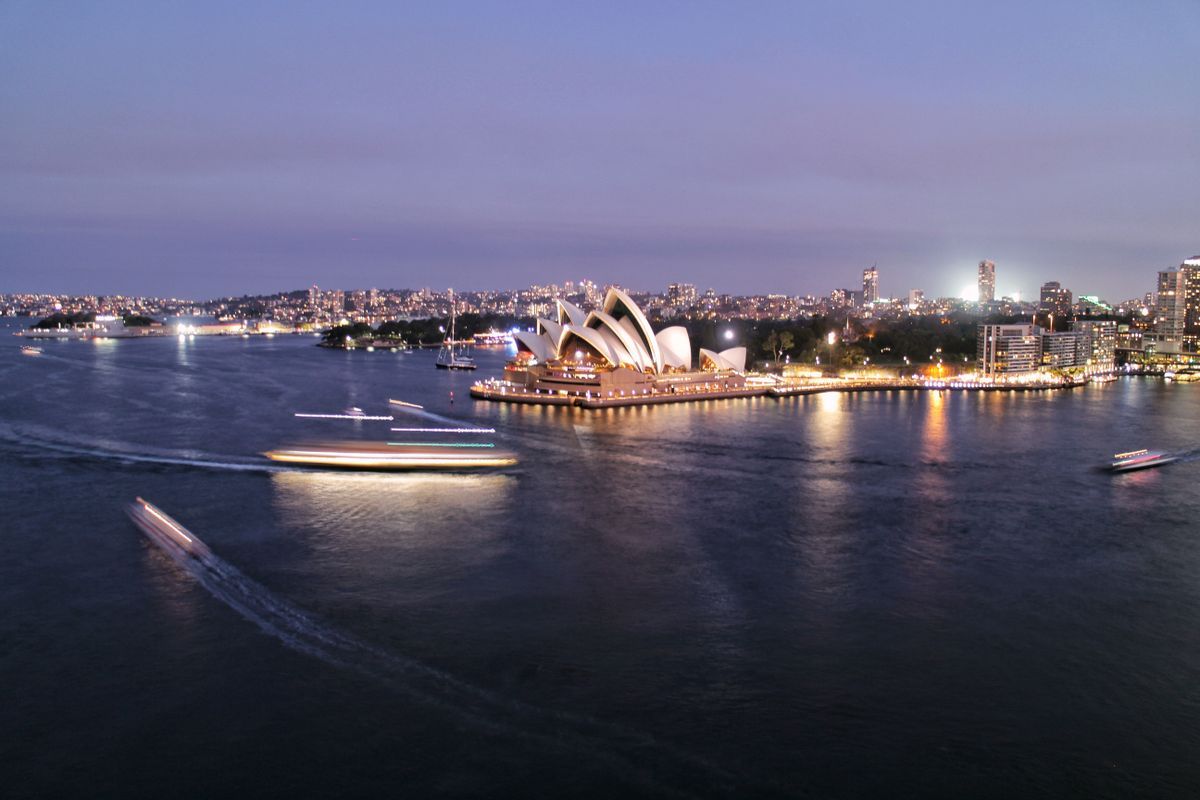
The Sydney Opera House and harbor glow at twilight
Set 3: Convert the Format
Convert each decimal pair to degrees, minutes, and seconds. The method: keep the whole degrees; multiply the fraction by 60 for minutes; keep the whole minutes; multiply the remaining fraction by 60 for seconds. Worked in full in the answers.
Grand Canyon South Rim: 36.061900, -112.107700
Old Faithful, Yellowstone: 44.460500, -110.828100
Mount Washington, New Hampshire: 44.270600, -71.303300
Answers. 1: 36° 03' 42.84" N, 112° 06' 27.72" W. Working for the latitude: 0.0619 × 60 = 3.714 minutes; 0.714 × 60 = 42.84 seconds. For the longitude: 0.1077 × 60 = 6.462; 0.462 × 60 = 27.72. The minus sign becomes the letter W. 2: 44° 27' 37.80" N, 110° 49' 41.16" W. 3: 44° 16' 14.16" N, 71° 18' 11.88" W. Check every one in the converter above; if your seconds differ by a rounding whisker, your method is right and your rounding is the only gap. The full teaching version of this conversion, including the reverse direction and spreadsheet formulas, is how to convert latitude and longitude to decimal degrees, which runs the same arithmetic in the other direction.
Set 4: Spot the Error
Each item below is a real pair that somebody mangled in one of the three classic ways. Name the error and give the corrected pair.
151.215297, -33.856784, labeled Sydney Opera House
33.856784, 151.215297, labeled Sydney Opera House
40.689167, 74.044444, labeled Statue of Liberty
95.240000, -2.120000, labeled a hilltop in Wales
Answers. 1: the pair is swapped. Latitude cannot be 151.2, so the numbers are in the wrong order; corrected: -33.856784, 151.215297. The range rule catches this one instantly, which is why it is the first check to run on any pair. 2: the minus sign was dropped from the latitude. As written, the point sits in the Pacific Ocean east of Japan; corrected: -33.856784, 151.215297. A point in an unexpected ocean is the classic symptom of a dropped sign. 3: the minus sign was dropped from the longitude. As written, the point sits in Kazakhstan, 10,409.3 km (6,468 mi) from the real statue, a distance computed with this site's own measurement code; corrected: 40.689167, -74.044444. 4: the latitude is impossible. Latitude ends at 90; 95.24 cannot exist, so this is a typo or a number that was never a latitude at all, and no correction can be guessed honestly: go back to the source.
Set 5: The Plus Code Round
Plus codes are the fourth costume of a pair. Try these, then verify in the converter.
The Central Park code 87G8Q2HJ+Q9 names a small cell in New York. What are the decimal coordinates of the point this site uses for Belvedere Castle in Central Park?
Which of these is the Sydney Opera House code: 4RRH46V8+74 or 87G8Q2HJ+Q9?
True or false: a plus code can be decoded without any internet connection.
Answers. 1: 40.779400, -73.969100. The code names a cell, about 13.8 m by 10.5 m at that latitude, and the castle point sits inside it; decoding the code returns the cell, and its center reads about 40.779438, -73.969063. 2: 4RRH46V8+74; the other is the Central Park code from question 1, so it cannot be Sydney's, and decoding either code in the converter settles it in seconds. 3: true. A plus code is pure arithmetic on the pair, which is why it works in any offline tool; the full explanation is in what is a plus code.
Scoring Yourself, and What to Do With a Weak Set
Five sets, five skills. Set 1 tests sign reading; a miss means drill the quadrant method in the concepts article. Set 2 tests anchors; a miss means your atlas needs a few more famous pairs, and Set 2 itself is the cure, so rerun it tomorrow. Set 3 tests the conversion arithmetic; a miss means slow down and write the two multiplications out rather than doing them in your head. Set 4 is the set that matters most in real life, because the errors in it are the ones that actually arrive in messages, forms, and spreadsheets; a miss here means adopt the three checks as a habit: range, signs, order. Set 5 tests the modern format; a miss costs nothing today and is fixed by ten minutes with the plus code article.
Retake the whole page in a week. The pairs will feel familiar, which is the point: fluency in coordinates is recognition, not calculation, and recognition is built exactly this way, by meeting real places more than once.
A Note for Teachers and Parents
These sets were built to be stolen. Each set fits on one printed page if you cut the answers, and the grading is gentle on purpose: the questions use places students have heard of, so a wrong answer feels like a puzzle missed rather than a fact unlearned. Two classroom habits multiply the value. First, insist on the prediction habit: before any answer is checked, every student says the quadrant aloud from the signs alone, because Set 1's skill is the gateway to all the others. Second, let Set 4 run as a detective game: the three classic errors, swapped, dropped sign, impossible value, are a complete taxonomy for beginners, and a student who can name the error type has learned more than one who can merely fix the digits. If your class has devices, the converter on this page is the answer key that never runs out; if it does not, the printed key above is complete and shows its working, which was the design requirement from the start.
Related Guides
The closest companions to this guide are the coordinates guides below. Each one picks up a thread this page starts:
How can I practice latitude and longitude without a teacher?
Work the sets on this page with the converter as your checker, then graduate to live practice: open any map, pick a place you know, predict its pair's quadrant and rough size before you look, and check yourself. Prediction before lookup is what turns exercises into skill.
Are these the real coordinates of these places?
Yes. Every pair on this page comes from this site's worked examples, and every conversion and code was produced with the same code that powers the tools on this page, which passes the official plus code test vectors. The Sydney and Statue of Liberty pairs are the standard published coordinates for those landmarks.
Why does the answer key show the working?
Because the errors students make are method errors, not answer errors. Seeing the two multiplications in Set 3, or the range check in Set 4, lets you find the exact step where your method and the key's method part company.
What is the most common mistake beginners make?
Dropping a minus sign, followed closely by swapping the pair. Together they account for nearly every wild coordinate a beginner meets, which is why Set 4 trains them by name and why the checks in that set are worth adopting as a permanent habit.
Can I use these exercises in a classroom?
Yes, freely. The sets are graded for it: Sets 1 and 2 suit a first lesson, Set 3 a second, and Set 4 makes a strong homework or quiz because the errors are realistic. The converter on the page serves as the class checking tool.
Photo credits: Kaboompics (Pexels); Patrick McLachlan (Pexels). Photos are served from this site; follow the credit to the library page for the original.