Every coordinate you have ever typed rests on decisions made across two thousand years, and the two halves of the pair had wildly different stories. Latitude fell early: any careful observer with a shadow stick could find it. Longitude took until the age of steam to solve, killed sailors by the fleet in the meantime, and ended not with a discovery but with a vote. Our companion article on latitude and longitude explains the grid as you use it today; this one tells how the grid got here, date by date.
Home / Coordinates and Location Formats
Latitude and Longitude History: From Eratosthenes to the Greenwich Vote
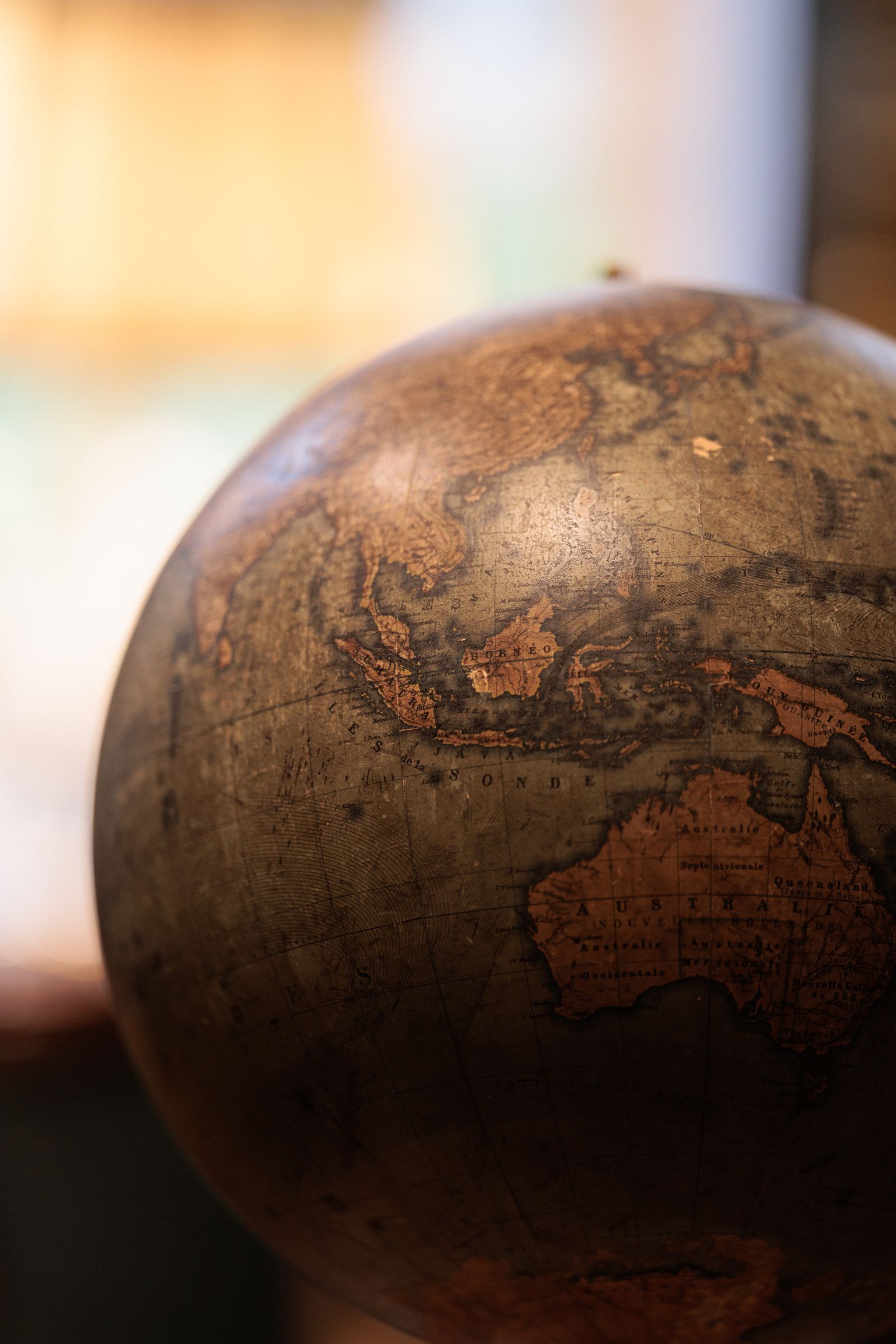
Photo: Alexander Popadin / Pexels
Interactive tool
The Longitude Story: Dates That Moved the Grid
Check off each step as you finish it. Your progress stays on this page.
0 of 6 complete
0% done
Eratosthenes Measures the Earth (Around 240 BCE)
The story opens with the librarian of Alexandria. Eratosthenes heard that at Syene, to the south, the sun stood directly overhead at noon on the summer solstice, casting no shadow, while at Alexandria at the same moment a vertical stick cast a shadow of about one fiftieth of a circle. From the angle and the known distance between the cities, he computed the Earth's circumference at roughly 250,000 stadia. Depending on which stadion he meant, that lands within a few percent of the true value, an astonishing result from two shadows and a road distance. The deeper point for our story: he had shown the Earth was measurable, and a measured sphere begs for a coordinate grid.
Hipparchus Proposes the Grid
A century later, the astronomer Hipparchus turned measurement into a system. He argued that places should be fixed by two numbers: their distance north or south of the equator, and their position east or west, determined by comparing local times of the same astronomical event, such as a lunar eclipse. In that proposal sits the entire modern idea. Latitude and longitude are exactly Hipparchus's pair, and his east west method, comparing clocks set by the heavens, is conceptually the same trick as the chronometer solution that finally worked nineteen centuries later. The grid was imagined long before it could be filled in.
Ptolemy's Geography (Around 150 CE)
Claudius Ptolemy, working in Alexandria around 150 CE, produced the grid's first great dataset. His Geography listed some 8,000 places with latitude and longitude values, enough to draw a map of the known world. His choices echo forward: he ran his prime meridian, longitude zero, through the Fortunate Isles (the Canaries), the westernmost land he knew, so that all longitudes in his world could be positive numbers counting east. Every later prime meridian, including Greenwich, is a descendant of that bookkeeping decision: put zero at an edge, or at your capital, and count from there. Ptolemy's numbers were often wrong, his Earth too small and his Asia too wide, errors that later encouraged Columbus, but the framework was immortal. When Renaissance scholars recovered the Geography, Europe relearned coordinates from it wholesale.

Latitude Solved, Longitude Stubborn
By the age of sail, the pair had split in difficulty. Latitude at sea was a solved routine: measure the sun's height at noon or the pole star's height at night with a quadrant, cross staff, or later a sextant, consult tables, and out came the latitude. Longitude had no sky sign to read. The Earth turns 15 degrees per hour, so longitude is a time difference: know the time at a reference meridian and your local time, and the difference is your longitude. But no clock could keep reference time on a rolling ship, and the astronomical alternatives were ferociously hard. So ships sailed the latitude to the right parallel, then ran east or west along it, guessing the rest. Guessing wrong about longitude meant meeting a coastline in the dark that the chart said was still over the horizon.
1707: The Scilly Disaster and 1714: The Longitude Act
The bill for that guesswork came due on the night of 22 October 1707, when a British fleet under Admiral Sir Cloudesley Shovell, believing itself safely west of France, struck the rocks of the Isles of Scilly. Four warships were lost and roughly 1,400 to 2,000 sailors died, in home waters, on a clear failure of position. The disaster became the public proof that longitude was a national emergency.
Parliament answered in 1714 with the Longitude Act, offering a graduated fortune: up to 20,000 pounds for a method that could fix longitude to within half a degree, with smaller prizes for accuracy within a degree and within two thirds of a degree. A Board of Longitude would judge the attempts. The money drew genius and cranks in equal measure, and the half degree bar quietly defined the problem: half a degree of longitude is two minutes of time. The winning clock would have to keep time to seconds across an ocean voyage.
Harrison and the H4 (1759)
John Harrison, a self taught Yorkshire clockmaker, spent his life on that bar. His first three sea clocks were magnificent wooden and brass machines, each years in the making. The fourth, H4, completed in 1759, changed the form entirely: it was a large watch, about 13 centimeters across, built to be carried rather than installed. On its trial voyage to Jamaica in 1761, H4 lost only about 5 seconds in 81 days, a performance comfortably inside the top prize band, off by a small fraction of the allowed error. The Board resisted, demanded more trials and full disclosure, and Harrison fought for years before Parliament finally paid him the balance of the reward in 1773, when he was 80. The lesson the grid remembers is not the feud but the fact: longitude became a carried time, and any ship that could afford a chronometer could know its east west position anywhere on Earth.
1884: The World Votes for Greenwich
By the late nineteenth century the remaining problem was not finding longitude but agreeing on zero. Nations counted from their own capitals and observatories: Paris, Washington, Greenwich, and others each anchored their charts. In October 1884, delegates from 25 nations met in Washington at the International Meridian Conference to pick one prime meridian for the world. They chose the meridian through the Royal Observatory at Greenwich, by a vote of 22 to 1, with France and Brazil abstaining. Greenwich won on installed base: most nautical charts and the dominant telegraph and railway networks already ran on it. France held out longest, keeping Paris time on its clocks for years afterward, but the grid had its zero. Latitude from the equator, longitude from Greenwich, degrees and minutes and seconds as Ptolemy would have recognized: the modern coordinate was complete, and everything since, GPS included, is that settlement computed by satellite instead of by shadow and chronometer.
The Rival Meridians: Paris, Ferro, and the Politics of Zero
Greenwich's victory was not unopposed, and the rivals explain what was really being decided in 1884. Paris ran its own meridian through its observatory, two degrees and change east of Greenwich, and French maps used it for generations, with French time itself defined by Paris until the early twentieth century; France's abstention in 1884 and its slow adoption afterward were national pride expressed in cartography. Ferro, the westernmost Canary island, was Ptolemy's zero and remained a working meridian on European maps for centuries because it conveniently placed all of Europe at positive longitudes. Other observatories, Cadiz, Washington, Rome, ran local zeros for their national charts. The patchwork meant a ship's longitude was meaningless without naming its meridian, a phrase like "longitude 15 degrees" carried an invisible footnote, and chart makers converted between zeros the way money changers converted coin. The 1884 conference was, at bottom, a standardization fight, and like most standardization fights it was won by the incumbent with the largest installed base: the Admiralty's charts were the world's charts, and the world's zero followed them to a hill in London.
Greenwich in the Satellite Age: The Line Moved a Hundred Meters
The story's best footnote arrived with GPS. The WGS 84 datum that your phone navigates by defines its zero meridian, the IERS Reference Meridian, by a global network of measurements rather than by one telescope, and that zero passes about a hundred meters east of the Airy transit circle in the Greenwich courtyard. Stand on the famous brass line with a phone in hand and the phone reads a longitude of roughly 0.0015 degrees west: the monument is not on the satellites' zero, because the satellites' zero was never defined by the monument. Nothing is broken. The 1884 zero was an astronomical direction, measured against the local vertical, and the modern zero is a geodetic convention fitted to the whole planet; the hundred meters is the accumulated difference between a hill's view of the sky and the Earth's center of mass. The brass line keeps the history, the phone keeps the planet, and the two zeros, like the three parts of the system itself, each answer to a different authority.
The Grid in Your Pocket
Every thread of this story converges in the device in your hand. Your phone's coordinates are Eratosthenes' insight (a measured Earth), Hipparchus' grid (two numbers for every place), Ptolemy's ambition (the whole world listed), the longitude race's prize (position found by carried time, now kept by atomic clocks in orbit), and 1884's standardization (one zero, one datum) running simultaneously, invisibly, a dozen times a day. The system feels obvious only because it won so completely. For most of human history it did not exist, and the people in this article built it one hard piece at a time, against shipwreck, politics, and the sheer difficulty of measuring a planet. The next time a map pin drops exactly where you stand, it is worth a second of respect for the two thousand years standing under it.
Related Guides
Readers working through this topic usually need its closest companions too. These coordinates guides cover the neighboring ground:
- Latitude, Longitude, and Time Zones: The 15-Degree Rule and Its Exceptions: Time zones are longitude wearing a clock.
- Latitude and Longitude to MGRS: How the Military Grid Reference System Works: MGRS turns a latitude and longitude into a compact grid reference like 18S UJ 23478 06483: a grid zone designator, a 100 kilometer square, and...
- Latitude and Longitude vs Northing and Easting: Degrees on a Globe vs Meters on a Grid: Latitude and longitude locate a point with angles on a globe; northing and easting locate it with meters on a flat grid inside one zone.
Frequently Asked Questions
Who invented latitude and longitude?
No single person did. Eratosthenes measured the Earth's size around 240 BCE and showed a grid was possible; Hipparchus proposed fixing places by a north south and an east west coordinate in the century after; and Ptolemy published the first great coordinate dataset, some 8,000 places, around 150 CE. The system accreted over four centuries of Greek astronomy.
Why was longitude so much harder than latitude?
Latitude has a sky reference anyone can read: the height of the sun at noon or of the pole star. Longitude is a time difference between your local time and the time at a reference meridian, and for most of history no clock could carry reference time across an ocean voyage. The astronomy existed; the timekeeping did not, until Harrison's chronometers in the 1700s.
What was the Longitude Act?
An act of the British Parliament in 1714 offering up to 20,000 pounds for a practical method of determining longitude at sea to within half a degree, with smaller prizes for lesser accuracy. It was passed after the 1707 Scilly disaster, in which a British fleet wrecked on its own coast through a failure of position, killed roughly 1,400 to 2,000 sailors, and made the longitude problem politically impossible to ignore.
How accurate was Harrison's H4 chronometer?
On its 1761 trial voyage to Jamaica, the H4 lost about 5 seconds over 81 days at sea, which corresponds to a longitude error far inside the half degree band required for the top Longitude Act prize. It proved that a portable clock could carry reference time accurately enough to fix longitude anywhere.
When did Greenwich become the prime meridian?
In October 1884, at the International Meridian Conference in Washington, where 25 nations participated and the Greenwich meridian was adopted by 22 votes to 1, with France and Brazil abstaining. Greenwich already dominated nautical charts and telegraph networks, and the vote made that practice the world standard.
Photo credits: Alexander Popadin (Pexels); jefe king (Pexels). Photos are served from this site; follow the credit to the library page for the original.