Army map reading looks intimidating because it is complete. The military teaches land navigation as one integrated system, map, grid, compass, and terrain, to people who must navigate at night, in weather, without batteries, and be right. The good news for civilian readers is that the system is also the clearest map education ever written down, codified in the US Army's map reading manual, FM 3-25.26, now TC 3-25.26, and every piece of it transfers directly to hiking, fieldwork, and search and rescue. This guide teaches the system's spine: the grid, the colors, the three norths, the terrain features, and the two position fixing techniques.
Home / GIS and Open Map Data for Beginners
How to Read Army Maps and Land Navigation: Grid References, Three Norths, and Terrain
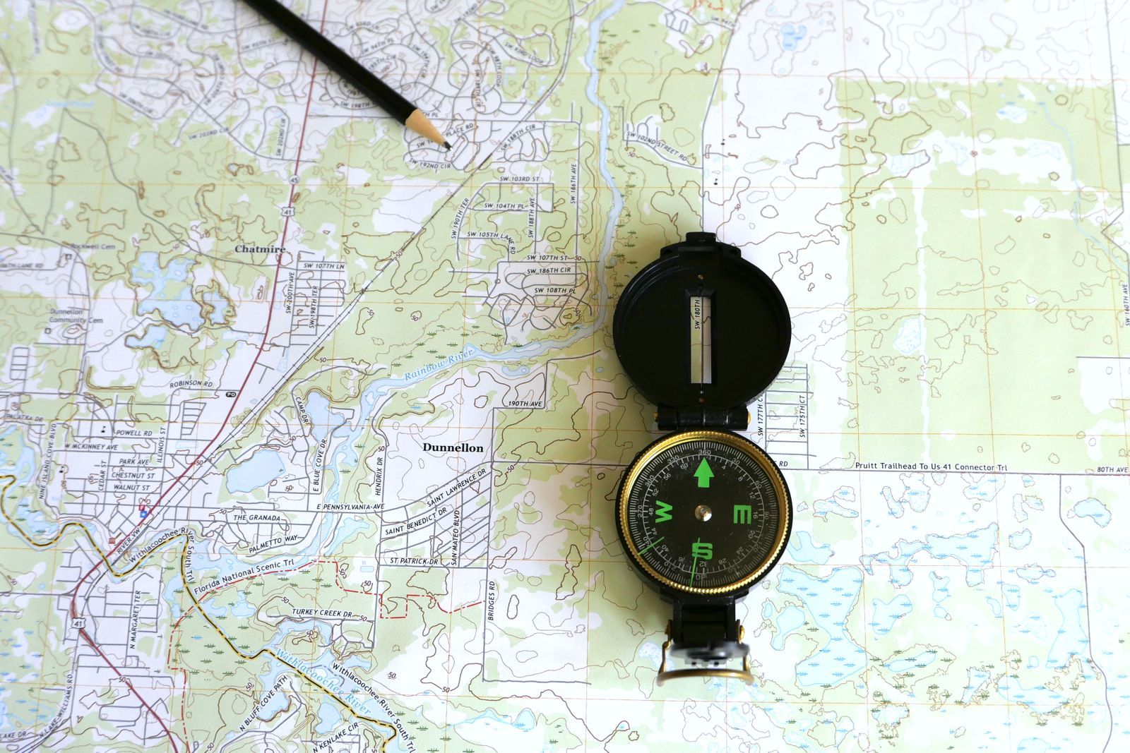
Photo: Larry Hyler / Pexels
Interactive map
Distance Measurer: Azimuth and Distance Between Real Places
Click two places and read the distance and azimuth between them. Then do the land navigation arithmetic on it: apply a G-M angle correction, and compute the back azimuth by adding or subtracting 180.
Total straight-line distance, 0 points
Click the map to start
Distances are great-circle (haversine, mean Earth radius 6,371 km): the shortest path over the surface, not a road or trail distance. Map data © OpenStreetMap contributors.
The Map and Its Grid
The standard teaching map is the 1:50,000 topographic sheet, where 1 centimeter on paper equals 500 meters on the ground. Across it lies the UTM based military grid: lines spaced 1,000 meters apart, forming squares of one square kilometer. Everything in land navigation is spoken in grid references built from those squares, and the reading rule is absolute: read right, then up. Find the vertical grid line to the LEFT of your point and read its number across the top or bottom margin, then find the horizontal line BELOW your point and read its number up the side. Right, then up, in that order, always; reversing it is the beginner's classic error, and instructors chant "read right and up" until it is reflex.
Precision is set by digit count, which is the system's elegance:
| Grid reference | Digits | Precision | Use |
|---|---|---|---|
| 4 digit | 2 + 2 | Within 1,000 meters | Naming a whole grid square |
| 6 digit | 3 + 3 | Within 100 meters | The field standard, a point in the square estimated in tenths |
| 8 digit | 4 + 4 | Within 10 meters | Precise targets and pickups |
For the 6 digit standard, you mentally divide the grid square into tenths and estimate where inside it the point falls: three digits right, three digits up. The full system adds a grid zone and a 100,000 meter square identifier in front, which our GPS coordinates vs UTM comparison explains from the coordinate side; on one map sheet, the digits above are what you use.
The Five Colors and What They Claim
Military topographic maps print in a standard color code worth memorizing, because it turns the map into a layered report:
- Black: human made features, buildings, roads' edges, labels, and boundaries.
- Blue: water, streams, lakes, swamps, and anything hydrographic.
- Green: vegetation, woods, orchards, and scrub, tinted where the trees are.
- Brown: relief and elevation, the contour lines and elevation numbers.
- Red: major roads, built up areas, and important boundaries on modern sheets.
Read a map by colors and you triage it instantly: brown tells you the shape of the ground, blue where you will get wet, green where you can hide, black and red where the people are. The legend discipline behind this is the same one in our civilian map legend symbols guide, tightened into doctrine.
The Three Norths and the G-M Angle
Your map knows three norths. True north points at the geographic pole, the direction of the star Polaris and of the map's neat lines' reference. Magnetic north is where your compass needle actually points, pulled by the Earth's field, and it wanders by location and year. Grid north is simply "up" along the printed grid lines, which differs slightly from true north because a flat grid cannot perfectly dress a curved Earth. The diagram in the map's margin states the angles between them for that sheet, and the G-M angle, the gap between grid north and magnetic north, is the one you apply in the field: it converts a direction measured on the map into a direction your compass can walk, and back. The field rule for applying declination style corrections is LARS: Left Add, Right Subtract, when converting from grid to magnetic azimuth, add the G-M angle if magnetic north lies left of grid north on the margin diagram, subtract if it lies right. Work one example until it is boring: the margin says the G-M angle is 8 degrees with magnetic north to the right; your map azimuth to the objective is 90 degrees; your compass azimuth is 90 minus 8, 82 degrees. Set 82, walk, arrive. Our compass reading guide drills the dial skills this conversion feeds, and how to use a compass covers the field procedure end to end.
Direction in Mils, and the Lensatic Compass
The military measures angles in mils: 6,400 of them in a circle, against the civilian 360 degrees. Mils subdivide more conveniently for field arithmetic and artillery heritage aside, the lensatic compass issued to soldiers reads in both, degrees on one scale, mils on the other. On the map, direction is measured with a protractor as an azimuth, the clockwise angle from north, and the reverse trip uses the back azimuth: add 180 degrees if your azimuth is under 180, subtract 180 if over. The measurer above gives you azimuths between real places to practice the addition until it is automatic.
The Terrain: Five Major Features
Terrain association is the skill that separates map readers from map owners, and the manual reduces landforms to five major features, all drawn by the brown contour lines whose grammar our contour map guide teaches in full:
- Hill: a closed contour loop with higher ground inside.
- Valley: a low corridor between higher ground, usually carrying a stream; contours V upstream.
- Ridge: a line of high ground with contours pointing downhill in U or V shapes along its spine.
- Saddle: the low dip between two higher areas, shaped like its namesake, the natural crossing point of a ridge.
- Depression: a closed low area, marked by contours with tick marks pointing downhill, hachured contours.
Three minor features complete the working set: a draw, the small valley carved into a hillside; a spur, the finger of high ground jutting from a ridge; and a cliff, where contours merge. Navigate by these, checking expected features off as they appear, and the map stays married to the ground. Our topographic map guide builds the same literacy from the civilian side.
Finding Yourself: Resection and Intersection
Resection locates you when you can see known landmarks. Take a compass azimuth to a mapped feature, convert it to a back azimuth on the map, and draw the line from that feature along your back azimuth; repeat with a second feature, and you stand where the lines cross. A third line forms a small triangle of error and honest confidence. Intersection is the mirror technique, locating a distant unknown point by drawing azimuth lines to it from two known positions. Both are pure right and up, three norths, and back azimuth discipline, which is the whole system's point: a handful of exact habits, chained, will put a beginner within 100 meters of anywhere on the sheet, in the dark, in the rain, with no battery at all. That is why the army still teaches it, and why it is worth learning from the manual's tradition rather than around it.
Distance by Pace Count, and Night Notes
Grid references tell you where things are; pace count tells you how far you have come between them, the dead reckoning half of the system. Calibrate on a measured 100 meters of flat ground: walk it naturally and count every double step, each time your left foot lands. Most adults land between 55 and 70 double paces per 100 meters, and your number, once measured, converts any walked leg into distance with an error of a few percent, corrected up for slopes and down for fatigue as you gain experience. Soldiers track the count with ranger beads, a cord of beads slid down per hundred meters, so the tally survives darkness and distraction. Night adds the rest of the craft: red light preserves night vision while you read the sheet, the lensatic compass carries a luminous dial for a reason, and azimuths walked at night are walked between near landmarks, short legs, because drift compounds unseen. The measurer above, fed the coordinates of your start and objective, gives you the planned distance and azimuth; pace count is how you know, boot by boot, whether the ground agrees with the plan.

From Reading to Moving: A First Exercise
The system's skills assemble into one beginner exercise worth doing before any real reliance. On a 1:50,000 sheet of a park you can visit, plot a three leg course between mapped features, each leg under a kilometer, and write for each leg its grid azimuth and its distance from the grid. Convert the azimuths with the sheet's G-M angle, calibrate your pace count on the park's flattest hundred meters, and walk the course by compass and pace alone, checking yourself at each feature before allowing a glance at any phone. Note where the errors crept in: they will be the classic ones, a transposed digit, a correction applied backwards, a pace count lost at a conversation, and each one is a lesson the manual's authors learned the same way a century ago. Repeat the course a month later and watch the errors halve. Land navigation is not a talent; it is this exercise, repeated, until the ground and the sheet tell the same story the first time.
Related Guides
If this page answered part of the question, these GIS and open map data guides cover the rest of the same ground:
- QGIS Elevation Profile: Read the Terrain Along Any Line You Draw: The Elevation Profile panel in QGIS turns a drawn line into a terrain cross-section: distance along the bottom, elevation up the side, with the...
- How to Learn GIS: A Four Stage Self Study Plan With an Artifact at Every Stage: Most GIS learning advice is a resource dump: forty links, three platforms, no order, and no way to know when you have actually learned anything.
- OpenStreetMap vs Overture Maps: The Living Database vs the Production Snapshot Built on Top of It: Overture Maps is not a rival to OpenStreetMap; it is built on it.
Frequently Asked Questions
What scale are army topographic maps?
The standard teaching and field sheet is 1:50,000, where one centimeter equals 500 meters on the ground and the printed grid squares are one kilometer. Other scales exist for other jobs, 1:25,000 for detail and 1:100,000 for planning, but land navigation training is built on the 1:50,000 sheet and its kilometer grid.
How do I read a military grid reference?
Right, then up. Read the number of the vertical grid line to the left of your point, then the number of the horizontal line below it. Four digits locate a whole one kilometer square; six digits, the field standard, add an estimated tenth in each direction for 100 meter precision; eight digits refine to 10 meters.
What are the three norths on a military map?
True north points to the geographic pole. Magnetic north is where a compass needle points. Grid north is straight up the printed grid lines. The map's margin diagram gives the angles between them, and the grid magnetic angle, the G-M angle, is the correction applied when converting between a map azimuth and a compass azimuth.
What does LARS mean in land navigation?
Left Add, Right Subtract. When converting a grid azimuth from the map to a magnetic azimuth for your compass, look at the margin diagram: if magnetic north lies to the left of grid north, add the G-M angle; if to the right, subtract it. The rule prevents the classic error of applying the correction in the wrong direction.
What are the five major terrain features?
Hill, valley, ridge, saddle, and depression. They are the landforms the contour lines describe and the backbone of terrain association, navigating by matching expected ground features to the map. Minor features worth adding are the draw, the spur, and the cliff.
How many mils are in a circle, and why does the military use them?
6,400 mils. The system divides the circle more finely than degrees for field measurement and has deep roots in artillery practice, where small angular units translate directly to distances at range. The lensatic compass carries both scales, mils and degrees, and land navigation courses teach azimuth work in both.
Photo credits: Larry Hyler (Pexels); Marina Leonova (Pexels). Photos are served from this site; follow the credit to the library page for the original.