QGIS is where GIS projects are built, but desks are not where data is collected. QField is the mobile companion that carries a QGIS project onto a phone or tablet and keeps working where there is no signal at all: farms, forests, survey sites, disaster zones, the places fieldwork actually happens. The catch is that QField's offline power is created back at the desk. A project thrown carelessly onto a phone fails in the field; a project packaged deliberately works all week. This guide is the deliberate packaging, start to finish. It assumes a working QGIS project; if you are new to the desktop side, our guide to using OpenStreetMap in QGIS covers basemaps and data there.
Home / GPS and Navigation Guides
QField Offline Maps: Package a QGIS Project for Fieldwork Without a Signal
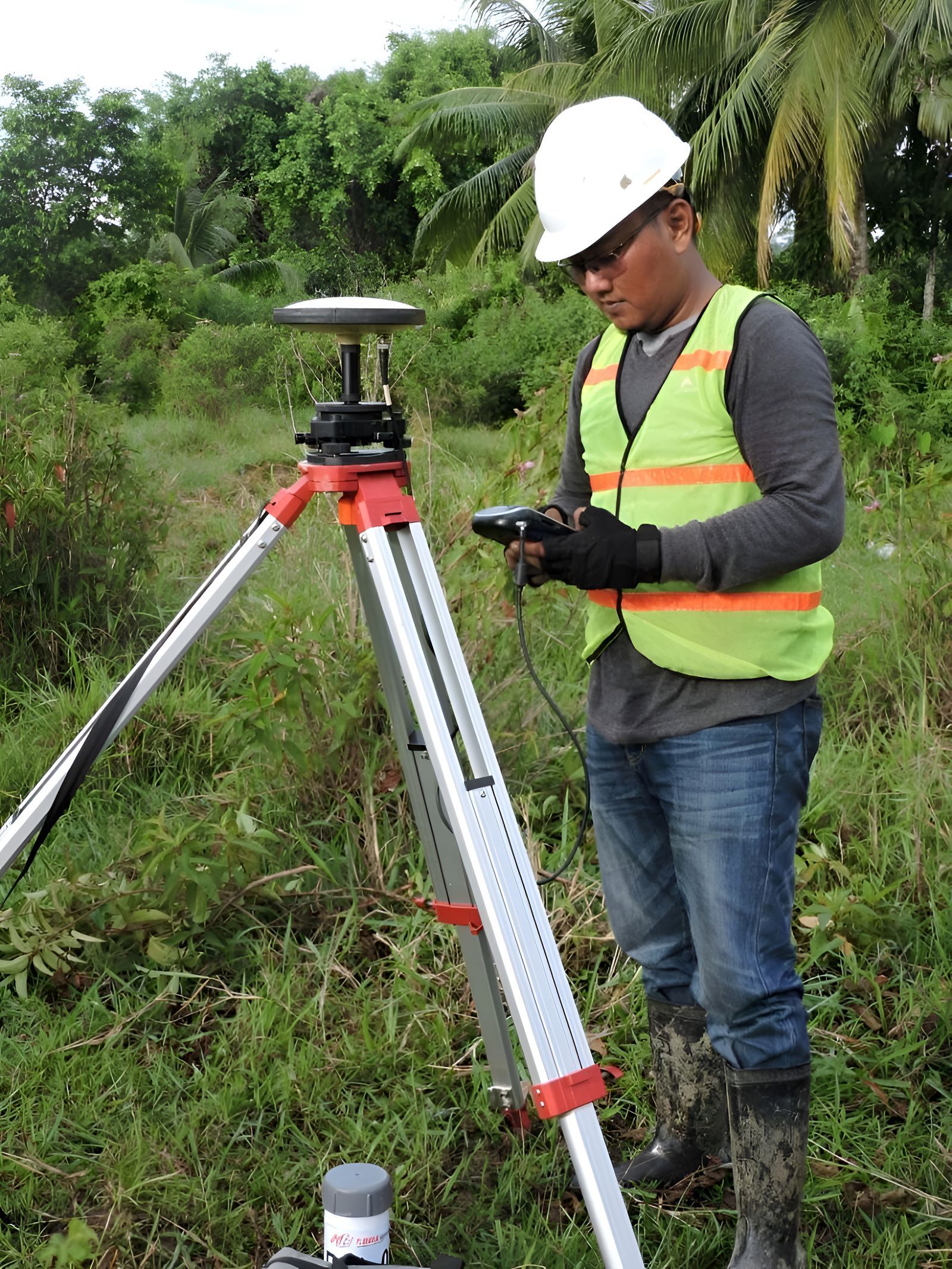
Photo: D'riva Motiva / Pexels
Interactive tool
Package a QField Project for Offline Work
Check off each step as you finish it. Your progress stays on this page.
0 of 7 complete
0% done
How QField Works: A Project, Not an App Export
QField does not import a map file the way a consumer app does. It opens the same QGIS project (a .qgs or .qgz file plus its data) and renders it with the same symbology, forms, and layer structure you built on the desktop. That fidelity is the point: the crew sees exactly the map the GIS team designed, including labels, rule-based styling, and attribute forms. It also means the project's data sources must be portable. A layer pointing at a file on your desktop's hard drive, a database on the office network, or a live web service will break the moment the project leaves the building. Packaging is the process of converting everything into self-contained files that travel with the project, and QFieldSync, the QGIS plugin built for this job, does most of that conversion for you.
Step by Step: Packaging With QFieldSync
- Install QFieldSync in QGIS from the plugin manager, and install QField on the phone or tablet from its app store.
- Tidy the desktop project first. Remove scratch layers, fix broken paths, and make sure every layer you need renders. Packaging faithfully preserves your mess.
- Configure the project for QField in QFieldSync's project configuration: for each layer, choose how it behaves (editable field layer, read-only reference, or removed), and set the offline behavior for web layers.
- Choose "Package for QField." QFieldSync exports a packaged copy: vector layers are converted to GeoPackage format, the project file is rewritten to point at the packaged data, and everything lands in one folder.
- Define the area of interest when prompted, so raster and basemap material is clipped to where you will actually work instead of the whole region.
- Transfer the folder to the device by USB cable, or push the project to QFieldCloud if your team uses it. The cable route is the true offline path: no account, no network, no surprises.
- Open the project in QField on the device before you leave. Walk the layers, open a form, drop a test feature. Every packaging mistake is cheap at the office and expensive at the trailhead.

The Basemap Problem: Your Background Layer Has No Internet
The most common packaging failure is the basemap. On the desktop, the background is usually a live tile service (OpenStreetMap or satellite imagery streamed on demand), and live services do not exist in a dead zone. The packaged project needs its background as a file. QFieldSync can generate an offline basemap for your area of interest from the configured web layer, baking the tiles into the package at the zoom levels you choose. Mind the trade: each extra zoom level multiplies the tile count and the file size, so pick zooms for the work (deep enough to read field boundaries, not deep enough to read license plates) and clip tightly to the area. Alternatively, teams with their own imagery can include a local raster (a GeoPackage or GeoTIFF of drone or aerial photography) as a project layer, which often beats any web basemap for fieldwork because it is current and theirs.
Editing in the Field: What Offline Really Means
In QField, an offline project is fully editable. You can add points, lines, and polygons, fill the attribute forms you designed in QGIS (complete with dropdowns, constraints, and default values), attach photographs through attachment fields, and use the device's GPS to place features at your position or to digitize a track as you walk. Snapping, geometry editing, and splitting tools work without a connection, because none of it ever needed one; the data lives in the packaged GeoPackages on the device. Your position shows from the phone's internal GPS by default, which is fine for asset mapping and inspection work at meter-level accuracy. The edits are stored in the project's data on the device, marked as changes, waiting for the trip home. Nothing is uploaded, streamed, or synced in the field, which is precisely the design: the field is assumed hostile to connectivity, and the workflow never argues with that assumption.
Getting the Data Home: Cable Sync and Cloud Sync
Two roads lead back to the desktop. The cable road: connect the device, copy the project folder back, and run QFieldSync's "Synchronize from QField," which merges the field edits into your master data, handling the changes made while offline. The cloud road: QFieldCloud stores the project centrally; the device downloads it before the field, works offline, and pushes changes when a connection returns, with the cloud resolving versions across a team. Cloud adds accounts, subscriptions for larger use, and team management; cable adds nothing but a cable. Solo workers and small crews often stay on cable for years. Multi-team projects, where three crews edit the same dataset from three valleys, are what the cloud is for. Either way, the rule is identical: synchronize and verify the merged result on the desktop before the device is wiped, repackaged, or sent out again.
External GNSS: When the Phone's GPS Is Not Good Enough
A phone's internal GPS is honest meter-level equipment. Survey-grade work needs more, and QField is built for it. The app connects to external GNSS receivers over Bluetooth and reads their NMEA position stream, so the feature you digitize lands where the receiver says, not where the phone guesses. With a receiver that accepts correction services (RTK over an NTRIP connection, which does need a data link, or a local base station), accuracy reaches the centimeter level surveyors work at, and QField displays the fix quality so you can see the precision you are recording with. The practical pairing is common in utility and land work: QGIS project designed at the office, QField on a rugged tablet, a GNSS receiver on a pole, and a packaged project that never touches the internet all day.
Design the Project for the Field, Not the Desk
A few desktop decisions decide whether fieldwork feels smooth or miserable. Build forms with big, glove-friendly controls and sensible defaults, because the person filling them is standing in weather. Set layers that should never be edited (parcels, imagery, reference grids) as read-only in the QField configuration so a stray tap cannot move a boundary. Pre-style with high-contrast symbology that survives sunlight on a cheap screen. Keep the layer count honest: twenty layers is a tool, sixty is an archeological dig performed with gloves on. And put the project's most important layer (the one being collected) at the top of the editing order with its form opening by default. Field software succeeds on ergonomics as much as features, and QField gives you the ergonomics controls back in QGIS, where they are easy to set and impossible to fix later from a mountainside.
Versions and Conflicts: The Multi-Crew Problem
Offline editing has one inherent hazard: while your crew is editing in a valley, the office may edit the same dataset, or a second crew may edit the same features in the next valley. QFieldSync's synchronization is built for the simple case, where field edits flow back into data nobody else touched, and it handles that cleanly. The hard case is simultaneous edits to the same feature, and no sync tool makes that free. The working defenses are organizational, not technical. Divide the territory or the feature classes so crews do not overlap (crew A takes the north sections, crew B the south; or one crew collects poles while another collects lines). Freeze office edits to field layers while crews are out. And sync nightly rather than weekly when a connection exists, because a conflict discovered after one day is an annoyance and after one week is an archeology project. QFieldCloud's versioning softens all of this by keeping a change history, which is the concrete reason larger operations pay for it: not the sync, but the undo.
A Field Day, Start to Finish
The workflow at its best looks like this. The night before, the GIS lead packages the project from the current master data and copies it to the tablets, checking each one opens the project and shows the offline basemap. In the morning, crews confirm their area of interest is fully inside the packaged basemap (the classic failure is a work site fifty meters beyond the basemap's edge, discovered at the site). In the field, the tablet runs all day in airplane mode, which nobody minds because nothing in the workflow wants a connection; battery life improves as a side effect. Features are collected with forms, photos attach to the features they describe, and the external receiver rides along for the points that need real precision. Back at base, tablets are plugged in, project folders copied back, and synchronization runs while the crew eats. The lead verifies the merged data in QGIS (counts features, spot-checks a few against the day's notes), and only then are the tablets cleared for tomorrow's package. Notice what is absent: no accounts were created in the field, no uploads were waited on, no signal was cursed. That absence is the entire product.
Related Guides
If this page answered part of the question, these GPS and navigation guides cover the rest of the same ground:
- Offline Maps for the UAE: Dubai and Abu Dhabi Without a Signal: The UAE looks like the easiest driving country on earth until your route leaves the city grid: desert highways between emirates, roaming charges...
- Offline Maps and Public Transport: Which Apps Still Route Buses and Trains Without Signal: Download an offline map and your transit directions quietly disappear: Google Maps' own help states that transit directions are not available in...
- Offline Maps on Apple Watch: How On This Watch Maps Work Without Your iPhone: An Apple Watch can navigate without your iPhone nearby, but only with the right kind of offline map on it, and the Maps app quietly distinguishes...
- QField for QGIS: Package the Project, Collect in the Field, Sync It Back: The packaging and sync system this basemap work belongs to, Copy against Offline editing included.
Frequently Asked Questions
Does QField work completely offline?
Yes. Once a project is packaged and transferred to the device, mapping, GPS positioning, and editing all work with no connection. Only optional services need a network: QFieldCloud sync, and RTK correction streams for centimeter-level external GNSS.
How do I get my QGIS project into QField?
Use the QFieldSync plugin in QGIS and choose Package for QField. It converts layers to GeoPackage, rewrites the project to use the packaged files, and produces a folder you copy to the device by cable, or push through QFieldCloud.
Why is my basemap blank in the field?
Because the desktop basemap was a live web service, which does not exist offline. Generate an offline basemap during packaging, clipped to your area of interest, or include a local raster layer such as your own aerial imagery.
How do field edits get back into QGIS?
Copy the project back and run QFieldSync's Synchronize from QField, which merges the offline edits into your master data, or use QFieldCloud, which pushes changes when the device reconnects and manages versions across a team.
Can QField use an external GPS receiver?
Yes. QField connects to external GNSS receivers over Bluetooth and positions features from the receiver's NMEA stream, including RTK-corrected centimeter positions when the receiver has a correction source.
Photo credits: D'riva Motiva (Pexels); Mikael Blomkvist (Pexels). Photos are served from this site; follow the credit to the library page for the original.